When I first started thinking about signing up for the Trailblaze Challenge in late January, I was waiting on the results of my MRI and I wasn’t sure what I would be able to do. Luckily, I got some good news and registered in early February. During our first meeting, we were all asked to introduce ourselves and tell everyone why we were there. There were people from all walks of life – young, old, in-shape, trying to get in shape, people who have had a personal experience with Make-A-Wish and others, like me, who were there because they like to hike, wanted to meet some new people and why not raise money for a good cause along the way.
In all of the hikes I did over the last 3 months, I kept extra weight in my pack (dog food is good for this!) so that I could start to train myself for my solo hikes in the Tetons in June and I kept my eye on my long-term goal of getting stronger and testing out new equipment. Along the way, I offered space on a shirt for a mantra or favorite quote to anyone who donated $25 or more to kick-start my fundraising and emailed friends and family with pleas for donations to raise the $2500 required of me. With a little less than a two weeks left to go in my fundraiser, I’ve raised 115% of my goal which doesn’t include all of the matching gift donations provided by donators’ companies.
The hike took me just over 11 hours to complete and while I started out with a lot of people, I found myself hiking alone for a lot of the time. I enjoy the solitude of hiking and this was no exception, but as I mentioned in a previous post, when hiking or running, I often find myself randomly jumping from one topic to another, so as I made it from 15 to 18 to 20 miles, lots of things popped into my head.
I thought back to the stories that were shared Friday night of the parents of a Wish kid who were doing this hike to give back to the organization that helped their daughter join a music cruise for her wish.
I thought a lot about the people who sponsored me, many had their own reasons for donating, including some with a more personal connection to the Make-A-Wish Foundation. Through their donations, I was able to go into hike day not worrying about having to meet this goal after the hike – I could just focus on the experience of the day.
I got mad at myself for not packing one of my sweat bands because it was hot! Which lead me to thinking about the one that I have that says “Because I Can” – whenever you take on something like this that others think is crazy, their first question is always why?!?!! I don’t have a good reason, other than, because I can… I can run, so why not run half marathons… I can walk, so why not hike 28.3 miles in one day. Not everyone can do that, so if I can, why shouldn’t I?
I have a friend from college who I got to know by playing soccer together for a couple years. The year after I graduated, he was in a sledding accident where he broke his neck and is now paralyzed. He may never play soccer again, but he’s adjusted to his new situation. He’s the co-founder of a company, PathVu, that is working to improve the accessibility and walkability of sidewalks and he’s taking his engineering background to pursue a Masters degree in Rehabilitation Science and Technology.
Sunday morning, as part of our wrap-up breakfast, everyone was given a pin and asked to dedicate it to someone based on their experience through this project. We heard a lot of stories of dedication to the person that the hiker had joined the challenge with, including the mother and father who were holding their baby as they tried to fathom what the families of Wish kids go through and the daughter who took her mother’s place in the hike with only 3 weeks’ notice, to the guy who doesn’t even live in Charlotte anymore, but came back for his third year in a row because the organization means so much to him that he’s now a Wish granter in his new city, to the supporters back home who told one hiker to suck it up when he broke his arm because it “wasn’t his leg,” to the new friends made on the trail and to the other hikers and Make-A-Wish staff who supported everyone on the trail, giving everyone supplies, massaging feet and forcing people off the trail for their own good, even when they wanted to try to go on.
Everyone had a unique story of why they joined, how they got to hike day and why they kept going for 28.3 miles… you never know what will happen tomorrow, so if you can, why not?
Category: Trailblaze Challenge
Officially a Trailblazer!
Saturday was the official 28.3 mile Trailblaze Challenge! Friday night we had a pasta dinner for all the hikers and you could hear the excitement build as everyone was coming in, meeting up with friends from previous hikes and talking about their expectations for the next day. After some good carbo-loading, we got the run-down of the morning festivities which included a 4:45am roll call and a quick departure by 5:00am. After we finished dinner, no one really knew what to do – we all knew we should be headed to bed, but it’s really hard to go to sleep when it’s still daylight! I got into bed shortly after 9:00pm and slept well, before waking to voices in the hall around 4:00am. When we left our room, we found that everyone’s doors had banners and streamers celebrating the challenge we were getting ready to undertake.

After a quick breakfast of a bagel with peanut butter and checking in via roll call, I jumped in a van with 9 other folks and we made the long trek to the start line in the Nantahala National Forest. When I was describing where this hike was going to take place, I kept telling people that it’s where North Carolina, South Carolina and Georgia meet – we were staying in a hotel in Georgia, but our hike started in North Carolina and ended in South Carolina. As we were driving to the start line, I saw the sign for the North Carolina State line and almost immediately we turned into a parking lot for the trailhead, so while we technically did start hiking in North Carolina, it was probably only about .1 of a mile – but I still hiked through 2 states!

It took us a little bit to get everything situated, but we were able to get a group shot of all of the hikers in the light of the vans and the early morning sunrise. After the group picture, we broke up into our hiking groups – since we had over 50 people hiking, we did a staggered start of 5-6 people in each group. I was in the 5th group and after a short stop at the trailhead sign for a picture, we were off! The rest of the group that I started with were all members of the same team, the Lake Wylie Blue Blazes, and we stuck together through the first section and leapfrogged one another until somewhere in the third section where I lost track of them. Not too far into our hike, as the sun was coming up, we came to a clearing where we could see out over Lake Jocassee.

Of course, since it was beautiful scenery and we all started hiking around the same time, we had a little bit of a crowd form as everyone stopped to take pictures. The first section of our hike was just under 5 miles (4.7) and while I had intentions of starting my Garmin before the hike, I forgot and it took forever for it to find the satellites, so I missed a bit of the first section, but it eventually got started – as we were headed uphill, of course. With the sun still coming up and promises of a hot day (it ended up around 80 degrees), I was pushing myself to get as many miles in before the sun was hot overhead.

After starting my hike at 6:22, I made it to aid station #1 at 8:05, which is just under 22 min/mile pace. Once I got to the aid station, I picked up a packet of almonds and used one of the few real bathrooms on the trail and then got started on my way again. Aid station #2 was 7.2 miles away and there we would have access to our “comfort bags” where I had stashed my M&M’s for later in the day.

Leaving aid station #1
During the second section of the hike, we started to hear (if not always see) the waterfalls that populated this part of the forest. There was more climbing in this section of the hike, but the biggest climb of the day was definitely in the first section – we started at around 2500′ and our first peak was around 3300′ – in the second section, there was another climb which lasted about 3 miles and went from 2650′ to 3050′. This section also included a lot of bridges over some of the smaller streams as well as some mud crossings and rock hopping.

I made it into aid station #2 at 10:44, which put my pace for the second section (7.2 miles) just over 22 min/mile. Since I’m not sure how long I stayed at the first aid station, I think my hiking time was actually a bit faster in this section than the first. At aid station #2, I took about 15 minutes to eat and change my socks. I had a small blister starting on my left heel and I figured I’d try out the BlisterShield I received in one of my Strideboxes earlier this year. That was probably my best decision of the day and I’ll be headed out to buy some more of this stuff! I thought it was going to be the consistency of body glide, so when I opened the package and it was a powder, I was a little thrown off (and of course, I didn’t read the directions), so I just put some of it into my hand and rubbed it all over both of my feet. I also broke out my gaiters because I was getting pretty good at kicking stuff into my boots. After that, I had no problems with blisters or sticks / leaves / other “stuff” in my boots! *note to self – just take the time to do the gaiters at the beginning of the hike!

Follow the white blazes and don’t go down the rabbit hole
Aid station #2 was getting pretty busy, so after I finished tending to my feet and grabbing my M&M’s, I quickly headed out onto the longest section of the day – 10.4 miles until the next aid station. The good news is that there was going to be a water station set up around the 8 mile mark so we could re-fill before we got the whole way to the aid station #3. After I left the aid station, I headed downhill for quite awhile before finding myself beside the Chattooga River which separates South Carolina from Georgia.

It was around this time that I started to get pretty hot and start going through my water more quickly. One of the things in our goodie bag when we checked into the hotel on Friday night was another Make-A-Wish bandana and I already had one tied to my pack, but

I figured I would bring this extra one with me, just in case I needed it for something. Walking next to the fast-moving water, I knew exactly what I was going to do with that bandana – soak it in water and put it on my head! It was the perfect way to keep the sweat out of my eyes and also help cool me down a bit in the heat of the afternoon. For the most part, I was hiking by myself at this point, but every now and then I would either catch up to someone or get passed by someone and as we got farther into this section, everyone I saw was wondering how much farther we had to go before we would find the water station we were promised. Since my Garmin didn’t start right when I started the hike, it was off by a little over a mile, so I was able to make a few guesses as to how much farther we had to go, but it wasn’t much help. By this point, I had emptied my 2L water bladder and was working on my reserve 16oz water bottle. I got about halfway through that bottle of water before I decided I should probably ration my water just in case we weren’t able to fill up at mile 8 like we were expecting. Instead, I broke out my beef jerky and chewed on that for awhile which seemed to work well.
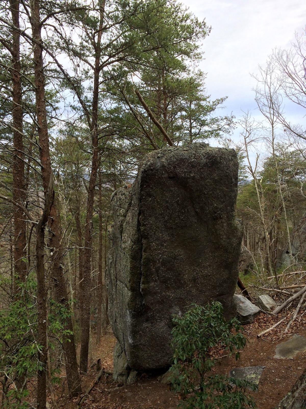
There were some interesting blazes on this section of the trail, including different markers for high tide and low tide. We were at low tide, but I went up the hill anyway, following the first white blaze I saw. I heard from someone at dinner who had take the lower trail that it was probably a much safer route to go up the hill – lots of slippery rocks to contend with on the lower route. Shortly after that section, I came to this trail marker…

At least one person at dinner didn’t remember seeing the giant arrow, but he made it through safely nonetheless. I also really like this trail marker where the tree is actually growing around the blaze…

I’m not 100% sure if this means that someone has cut out the section of the tree where the blaze was originally painted instead of repainting it or if the paint has actually caused the tree to leave a hole in the middle. Even though there was no extra water stop at mile 8, I eventually made it to aid station #3.
By this point, my watch battery had died, I had less than 8oz. of water on me and my left IT band was hurting every time I went downhill, but I only had 6 miles to go! I did continue to slow down in section #3, finishing the 10.4 miles at about a 24 min/mile pace. One of the volunteers graciously filled up my hydration bladder and after eating another peanut butter and jelly sandwich, I headed out to tackle the last section of the trail.

My goal for the day was to finish in less than 12 hours, and coming into aid station #3 at 3:15pm, I thought that was definitely still doable. As I was getting ready to leave the aid station, one of the volunteers told me it would be an easy 6 miles out and “all downhill” which definitely didn’t excite me since downhill was the only time I was having pain. The good news is that while there was some downhill, most of it was gradual enough that I didn’t have too much pain. I left the aid station before either of the other women who were there, but was quickly passed by a woman, Debbie, who had her feet taped by the EMTs at the aid station. After a mile or so of hiking by myself again, I saw her sitting on the side of the trail taking off all of the tape because it was actually causing her more pain than before it was taped. Once she told me she would be fine, I headed off again.
With about 4 miles to go in the hike, I decided that trying to coordinate my feet and my hiking poles was too much work mentally, so I strapped them to my pack and just walked the rest of the way without them. Debbie caught back up to me with a little less than 2 miles to go and we stuck together through the rest of the hike. We passed a guy who told us we only had a 2 minute walk to go until the finish and soon enough, we could see the vans through the trees and eventually, the finish line sign.
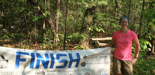
We dropped our packs at the finish line, did some stretching and I went back for an obligatory finish line photo.

Almost as soon as we finished, the other hikers who had finished before us started grabbing their things because we now had enough people to warrant a bus back to the hotel. Those hikers were definitely excited because some of them had been waiting for about an hour, but I felt a little rushed to grab my things and get into the van. I didn’t even get to take off my boots before jumping in the van for a 30 minute ride back to the hotel. But, as soon as I could sit down, I was happy to just not be walking anymore!
Saturday finished with a dinner back at the hotel and at least one guest at the hotel (who was clearly not part of our group) asked one of the hikers what we did that we were all walking funny. It was great to re-group with everyone back at the hotel and hear stories from the different groups that ended up together on the trail.
Have you ever taken on a challenge like this?
Trailblaze Challenge: South Mountain State Park – take 2!
People always ask me what I think about when I’m running or hiking these long distances, so I’ll give you a quick glimpse into what a lot of this hike looked like…
*singing in my head*
Don’t you dare look back.
Just keep your eyes on me.
I said, You’re holding back,’
She said, ‘Shut up and dance with me!’
This woman is my destiny
She said, ‘Oh, oh, oh,
Shut up and dance with me.’
Yes, these are the only words I remembered, so repeat that a few times in a row and then try to think of a different song to sing… and then just start singing the same song again.
I also like to distract myself by doing math – once you get into double digit division, it makes things a lot harder! Especially when you’re trying to convert minutes to hours and back again while keeping track of your pace and mileage as well. When I was running my marathon, by the time I would figure out what my pace at the last mile marker was, it was time to recalculate again.
So, if you ever need things to distract you, I highly recommend songs with lots of repeating words and long division! But on to the actual hike…
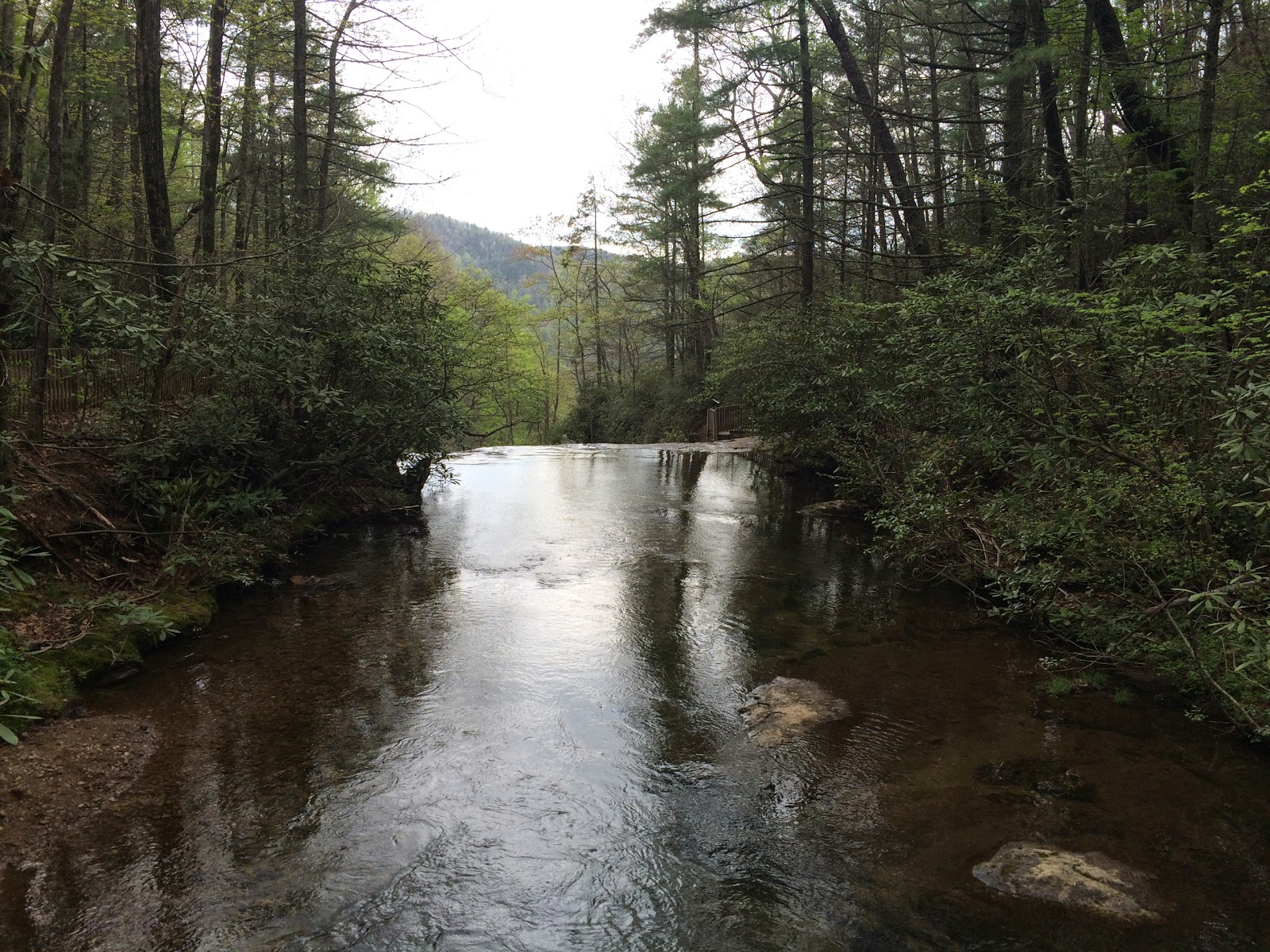
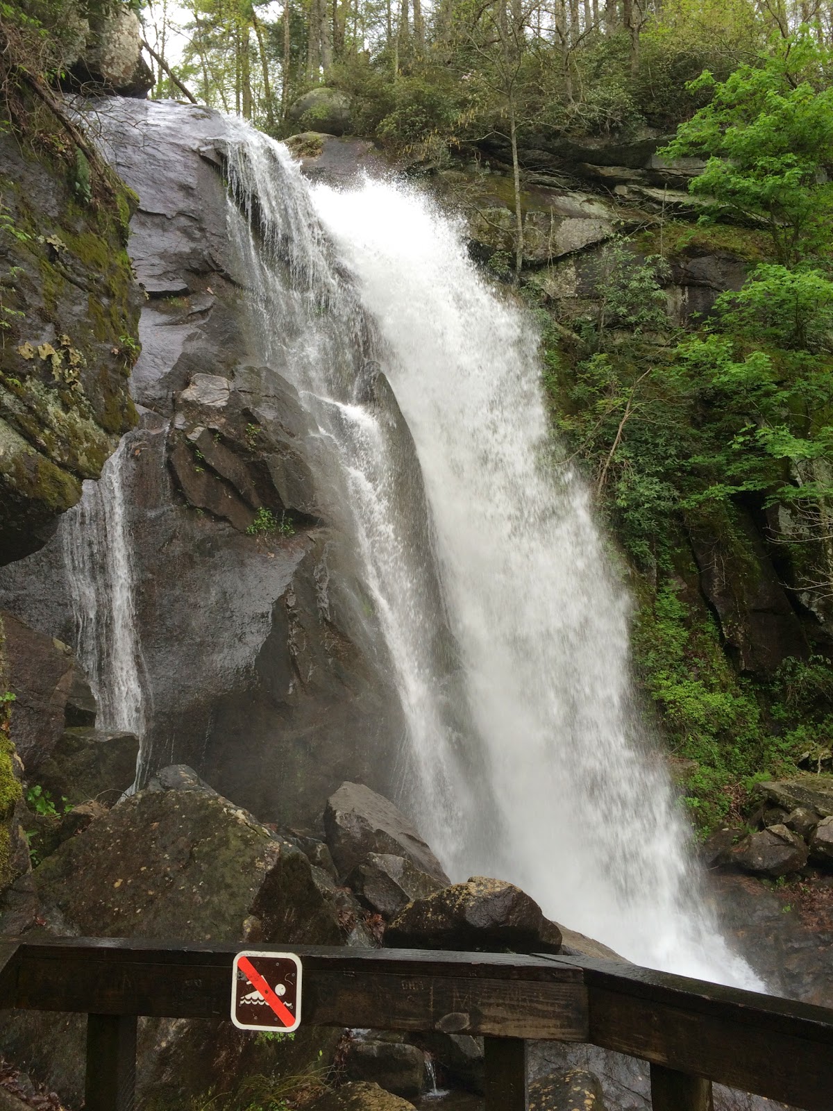
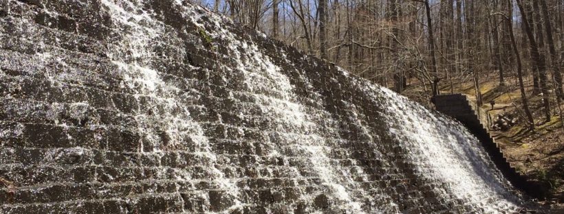
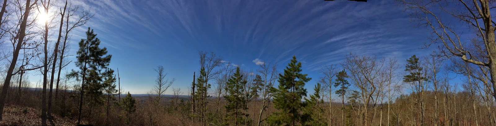
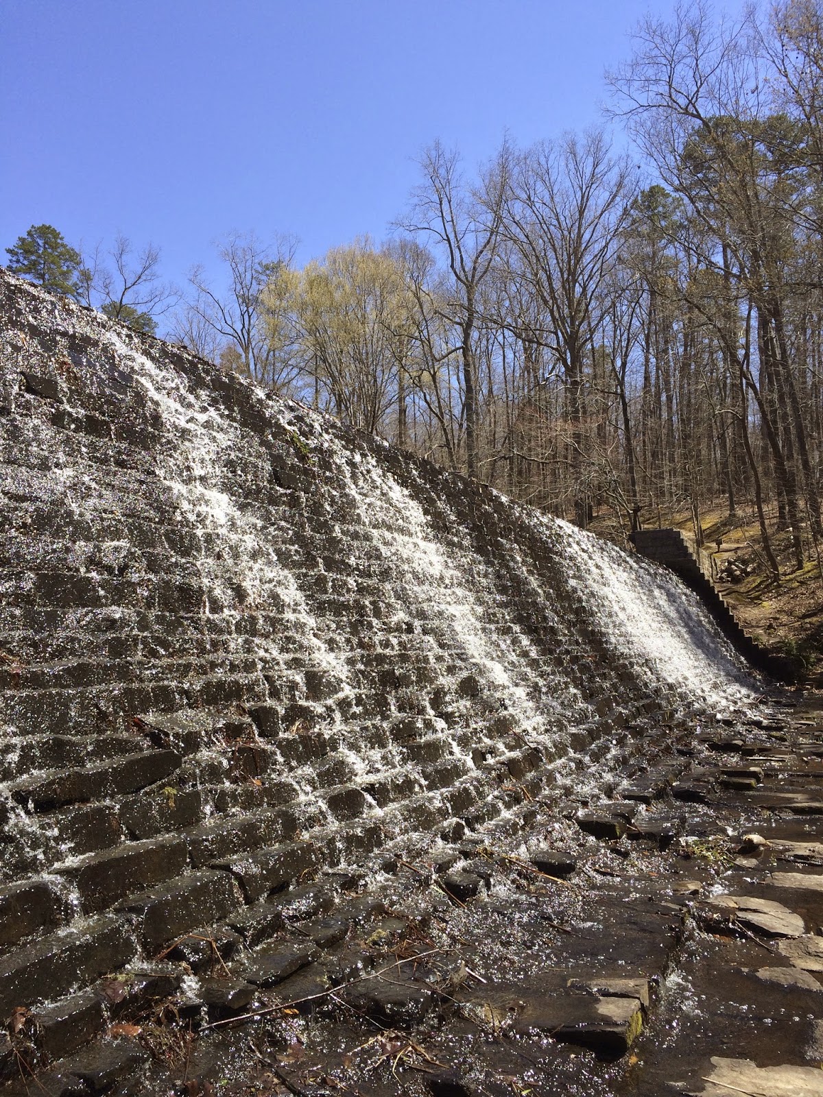
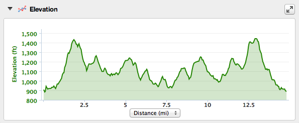
We hiked at South Mountain earlier in our training, and as part of that, I took a detour to see the waterfall since I hadn’t been there before. This time, we were going to finish by going down all the stairs beside the waterfall. Originally, we were supposed to do a 22-mile hike, but due to the strenuous hike at Stone Mountain a few weeks ago, the group leaders decided to change things up and create a difficult, but shorter route covering 13 miles.
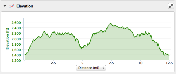

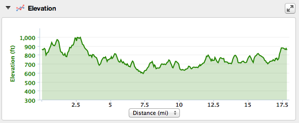
As you can tell, this hike had a lot of elevation change again, and you can actually almost see the stairs as we start to descend after mile 10. Because of the route that we went, we did get to see some good views of the rest of the mountains near the beginning of our hike.
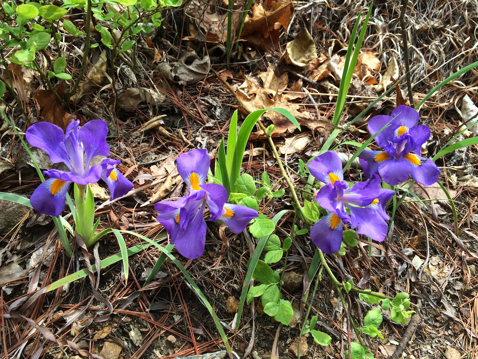
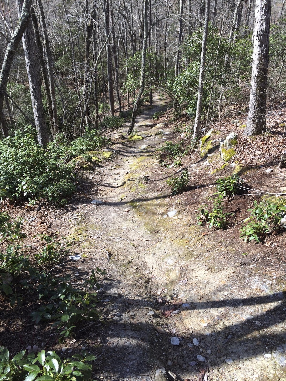
Again for this hike, our group spread out pretty quickly, so there were times I was hiking with 3-4 other people and then times when it would just be me for awhile. I could definitely tell that spring had finally settled into the mountains – the trees had a lot more leaves on them, there was a lot more undergrowth started, and you could see flowers starting to poke out everywhere!
At one point during the hike (and I’m not entirely sure where), we actually passed a cemetery. It’s hard to see most of the stones, but there’s a fairly prominent one to the left of the big tree on the right side of the picture.
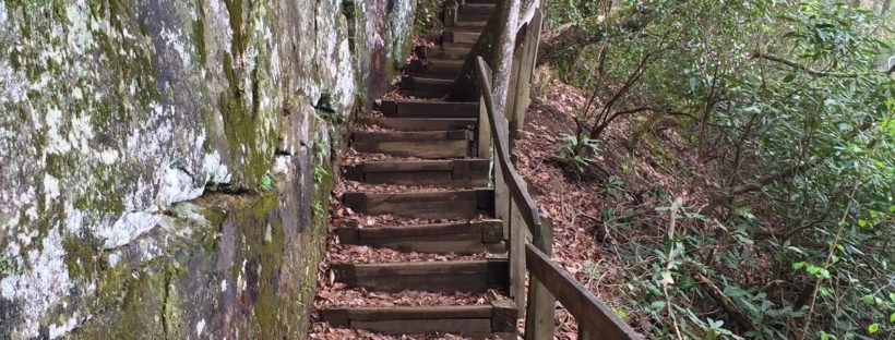
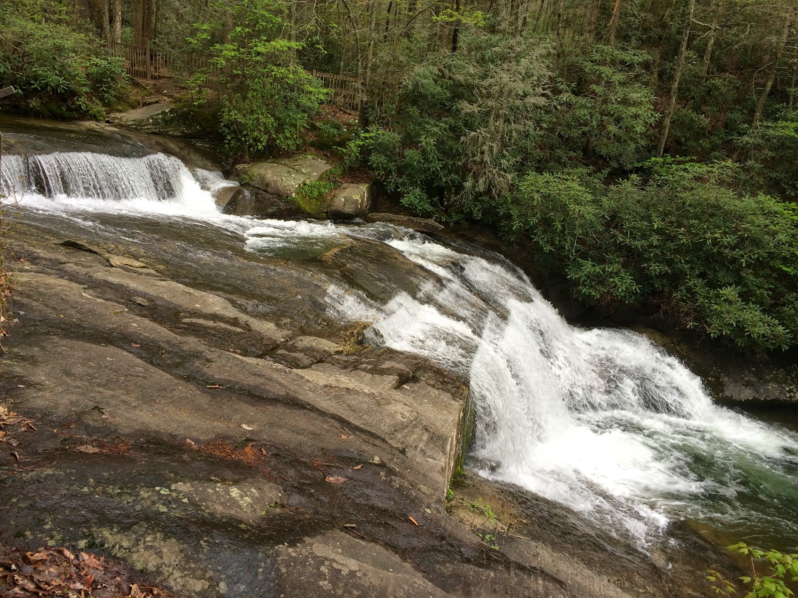
Finally, we got to the top of the waterfall and I realized that I hadn’t even come close to it the last time I was hiking! To start our descent, we actually crossed a bridge over the top of the falls.
And, then there were two sets of smaller falls before we got to see the big falls.
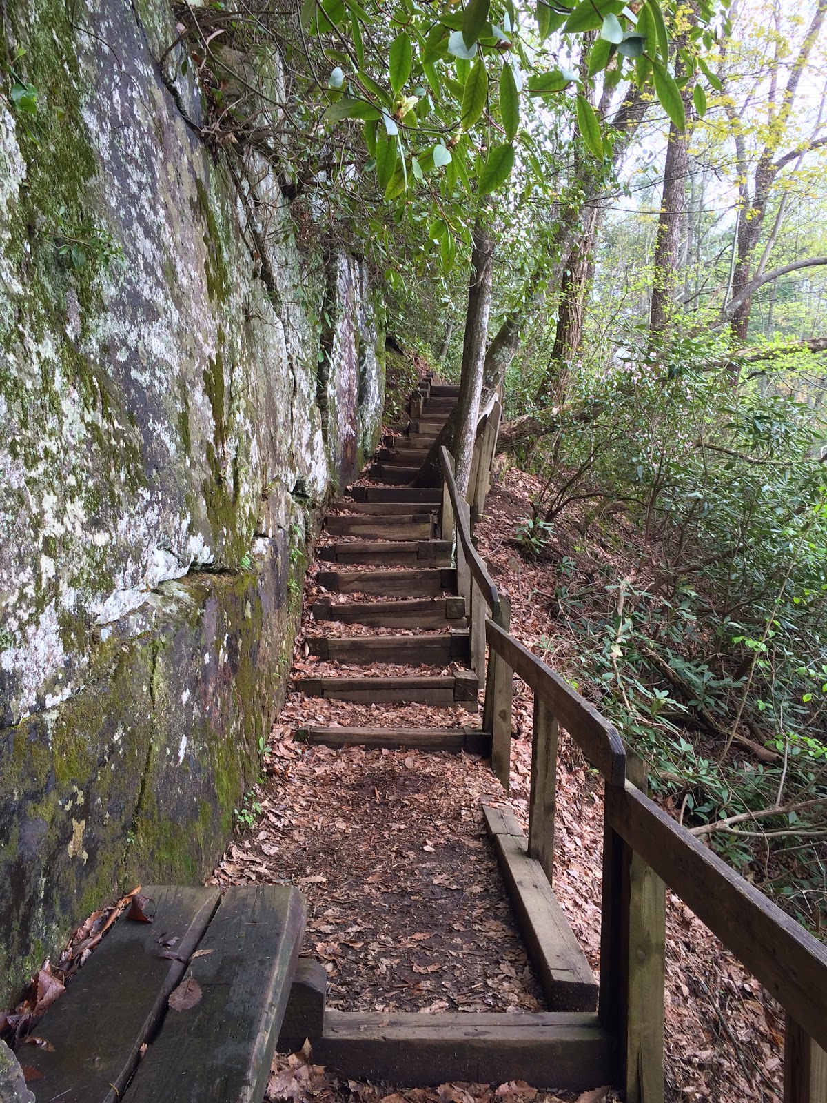
I thought about trying to count the number of steps we went down, but I realized pretty quickly that was going to be a fruitless effort – there were way too many!
I did a quick stop over at the falls, but since I had been there before and because my legs were already pretty shaky, I decided not to linger too long.
After the falls, there were still a lot more steps down to the bottom where it opened up into a wide trail again. There were a lot more people on this section of the trail, including a lot of dogs who appeared to enjoy the water on their way up to view the falls. Overall, my legs felt good on this hike, but the repeated downhill steps definitely took their toll.
The total hike was 12.5 miles and it took me 5:13 which means I was averaging about a 25 minute pace, which seems to be a pretty consistent pace for me. At that pace, my 28.3 mile hike should take a little less than 12 hours, so hopefully I can stay in that range. Just less than 2 weeks to go!
Trailblaze Challenge: Stone Mountain State Park
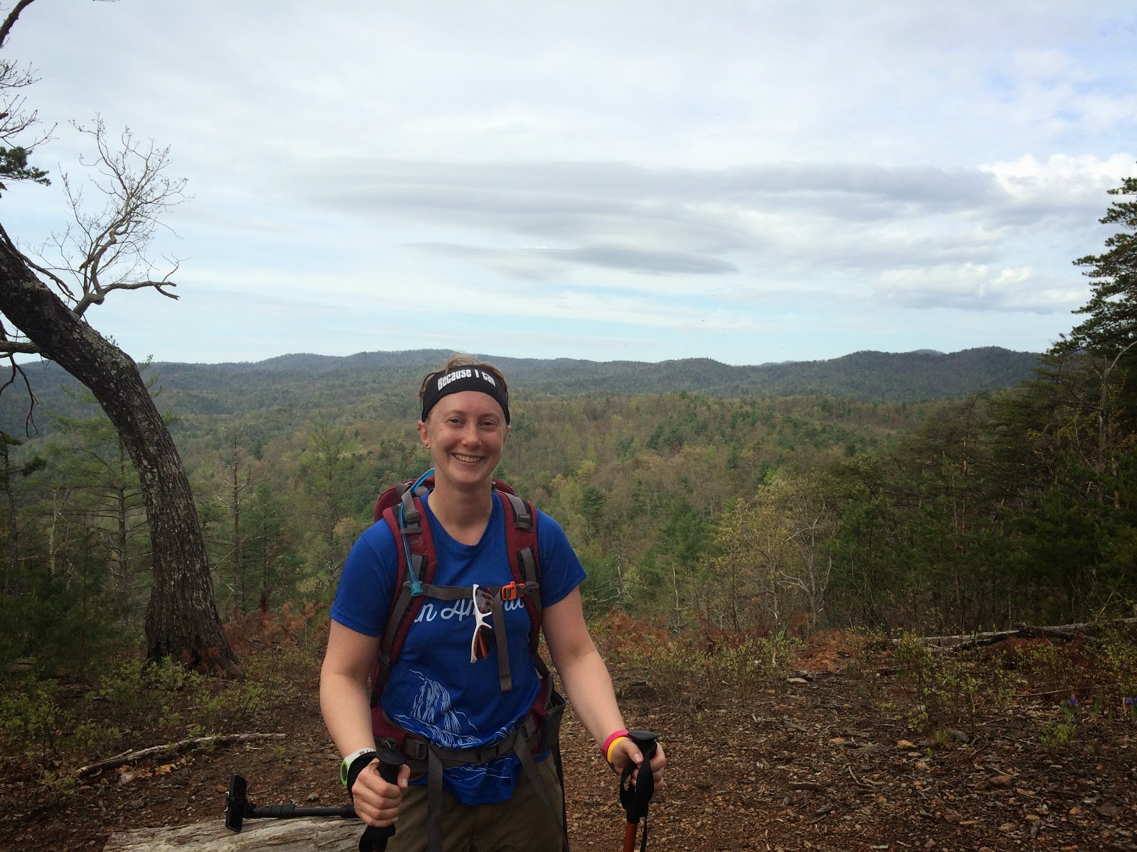
Last weekend, the weather was in the upper 40’s and now we’re hitting almost double that. The good news is that it looks like it will be cooling down a little bit for this weekend’s Rock ‘n’ Roll Raleigh half marathon. But, back to last weekend! I headed out to Stone Mountain State Park to meet up with my hiking group to do the second-to-last long training hike. Unfortunately, it took me a little longer to get to the meeting spot than I was expecting, so I ended up missing the group as they started on the trailhead, but I knew with the varying paces of the group, I should see people throughout the hike. So, I grabbed my gear and started walking to the trailhead… and promptly turned around when I realized I had forgotten one of my new pieces that I wanted to try out on this hike – my trekking poles. Now that I was 30 minutes behind the group, I was ready to get started! Everyone kept recommending hiking poles and I’ve been on the fence for several weeks whether or not I really wanted them, but when I went into REI and asked about renting them, they didn’t have that as an option, but they did have them 30% off, so I figured it was worth at least taking them out for this long hike and testing them on the steep trail I kept hearing about. They weren’t kidding about the elevation change and challenge that this trail would provide.

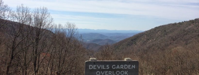
The hikers normally end up splitting up based on pace and I caught my first group near the base of the major hill and my second group around 5 miles in and I’m glad I caught the second group because there were a couple of areas where the direction of the trail wasn’t clear, especially when we got 6 miles in and the directions on my map ended… we ended up at Devils Garden Overlook on the Blue Ridge Parkway and still had 3 miles to go before our official turnaround, but the trail actually continued on the other side of the parkway, and while you could see the sign, it was a little confusing because I didn’t realize we were supposed to keep going at that point.
Once we got onto the parkway, the wind really picked up and made me glad I had packed my light rain jacket which is also windproof to 50 mph. After crossing over the road, we went another mile or so before coming up to the parkway again. Again, it was a little hard to follow the trail, but there were a few signs, so I was able to follow it along the road before it cut back into a field.
As I was coming out of the woods the second time, I could still see one of the other hikers in front of me, but as I turned through the field and back into the woods, I quickly lost him in the thick woods.
Let’s play find the trail!
There were definitely times when I wasn’t sure if I was still on the right path, but just as I was thinking I would need to turn around to look for the blaze, I would see another one. Eventually, I made my way to the cabin where I found 3 more of the trailblazer crew eating their lunch.

Once I got to the cabin, I realized that I had caught up to the front of the pack which wasn’t too bad considering they had a 30 minute lead on me. Everyone stuck around for 10-15 minutes eating, resting and tending to their feet before heading on the 9-mile return trip. I spent most of the time on the way back hiking on my own and I realized that I wasn’t really “looking around” much when I was hiking up the major hill at the beginning. Here’s some things I missed on my initial pass:
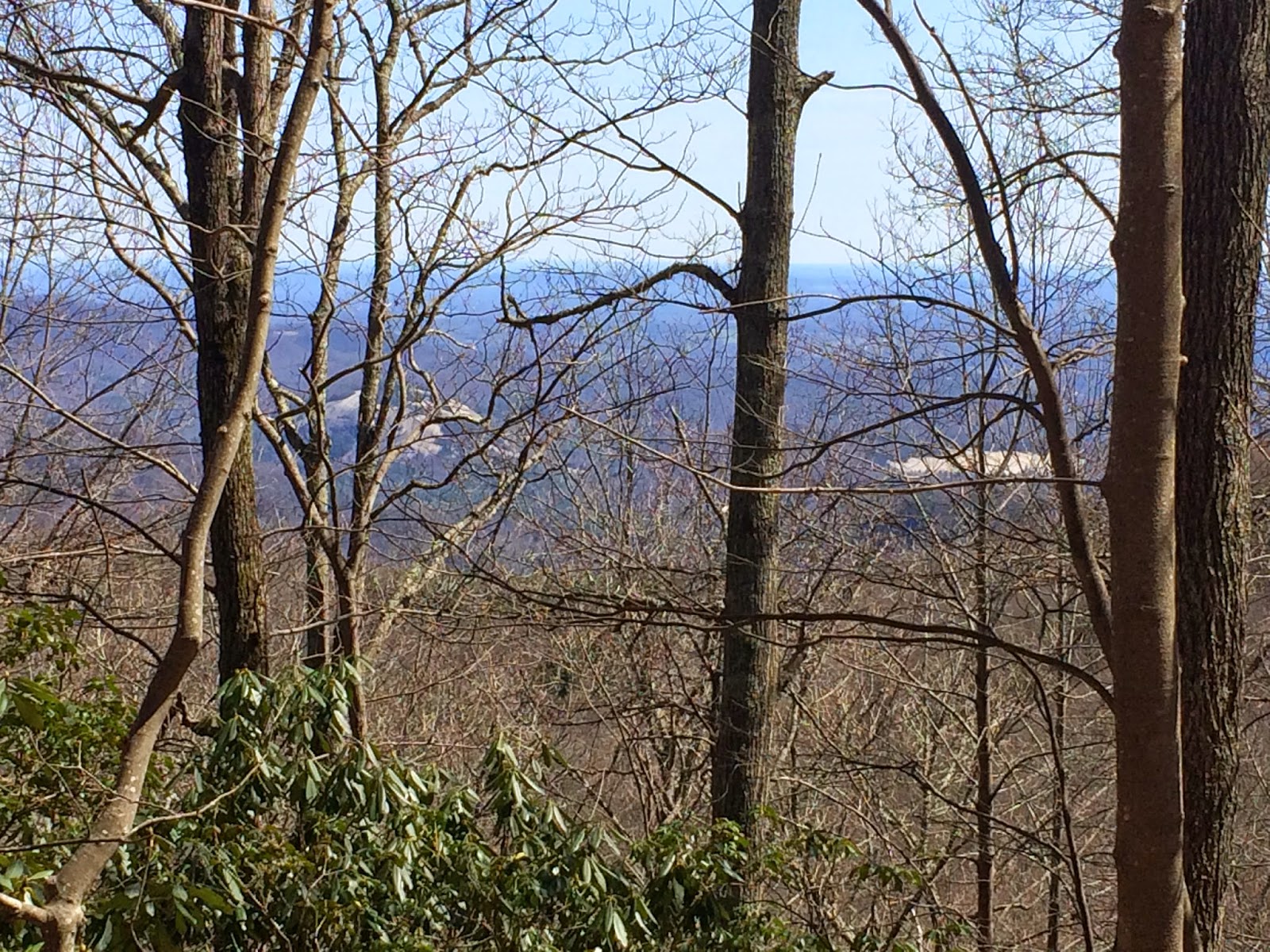
All the white you can see is the stone of Stone Mountain State Park where you can find another hiking trail and, of course, rock climbers. I’ve actually been on that trail before and originally, that’s what I had assumed we were hiking for this trek.

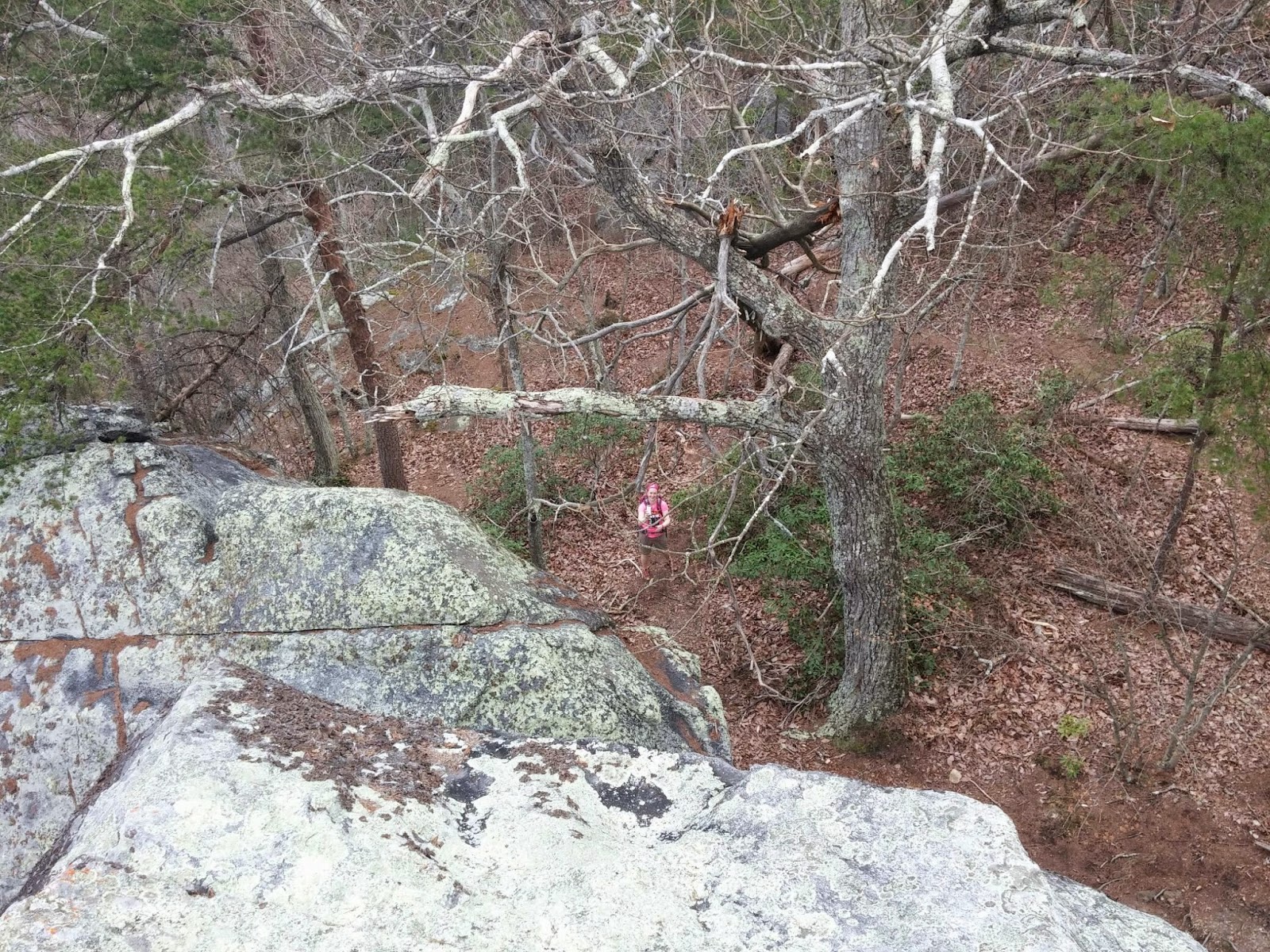
I really don’t know how I missed this since it was only 20-30 feet off of the trail, but apparently my attention was focused in the other direction. I tried to take some pictures of how steep the trail was from the top…
… but I still think it’s more impressive / scary from the bottom, looking up!
The good news is that I didn’t have any knee pain this week and while it took me a bit longer than I was expecting, just over 7 hours for 18 miles, it was a really good hike. I also got to try out some new gear, including new socks (slightly shorter wool socks) and my trekking poles, which I used a lot in the downhill section at the end. Only one more long hike and 4 weeks before the big hike!
Trailblaze Challenge: Kings Mountain State Park
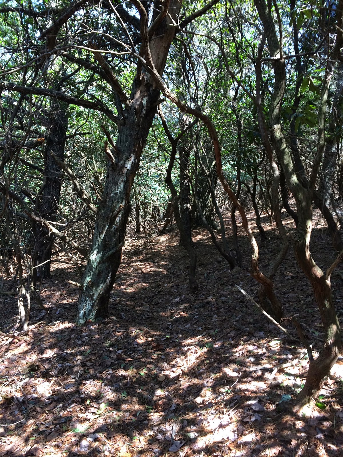
Last weekend was a solo hike at Kings Mountain State Park in South Carolina. This park actually connects to Crowder’s Mountain via the Ridgeline Trail that I did previously. I was looking for another trail in the 15-17 mile range and ended up making this one almost 18 miles due to some detours I made from the trail (some planned, some not!). The weather last weekend was a bit of a cold spell compared to what we’ve been having, so when I started, it was in the low 30’s and I had a ton of layers on. Since I’m using these training hikes to learn more about what I want to take on my long trip in June, this was actually perfect weather for me to test out what I thought I wanted to wear and then learn why those were bad choices.
The beginning of the hike was some good elevation change, so I quickly took off my gloves, hat and jacket before I even hit the first detour around mile 2 where I peeled off of the hiking trail (there’s only one) and headed up to the top of Browns Mountain which topped off at 1045 feet.
I know I usually post a lot of pictures showing how much climbing there is on these hikes, because there is, but with that climbing, there is also occasionally some good downhill hiking too.
By 4.5 miles in, I was regretting adding leggings under my quick-dry zip-off pants and this is one of the things I was planning to take with me / wear on my long hiking trip as I think there will be some cold mornings on the trail, but even though it hadn’t hit 40 degrees yet, I was starting to get a bit warm with the two layers. By mile 7, I decided that I was going to get rid of the leggings, so I found a nice stump to lean against and stripped in the middle of the woods – by this point it was 43 degrees and I was definitely overdressed! After that, I was much more comfortable and through the rest of the hike, I alternated between wearing my arm sleeves and taking them off, depending on whether the wind or the sun was winning.
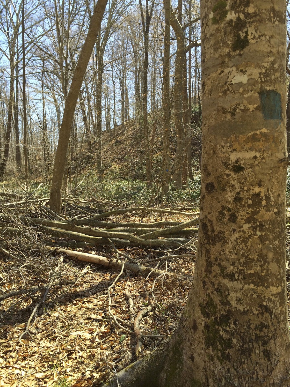
Though this was a clearly marked trail, it doesn’t look like it’s highly traveled and there were a lot of downed trees on various parts of the trail. Some of the time, they were able to be climbed over or under and occasionally there was another well-worn side trail which indicated the trees had been there for quite some time.
As I was coming up to the detour for Lake Crawford, I wasn’t sure if I wanted to do it. Because of the initial detour for Browns Mountain, I was already almost at 14 miles, but I figured the lake would be another good photo opportunity, so I headed that way. I started to see a lot more people as I took this spur trail and made it to the lake in about .5 of a mile and while I didn’t do the short loop around the lake, I did enjoy the part I got to see. I also got to answer questions from several other people who were at the park that day… apparently if you’re wearing a pack, you look like you know what you’re doing, so I got to help a couple people find the trail that went around the lake and helped a mother and son decide if they wanted to continue on the spur trail away from the lake based on how far I knew it was to the trailhead.
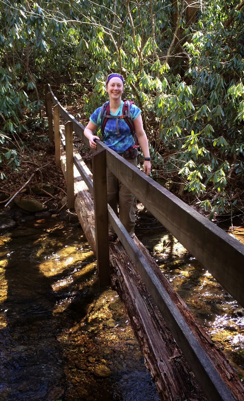
After finishing at the lake, I headed back to the main trail and came to a section where a bridge used to be and then another few feet down the stream, there were boards strewn across as a make-shift bridge, which actually worked pretty well.
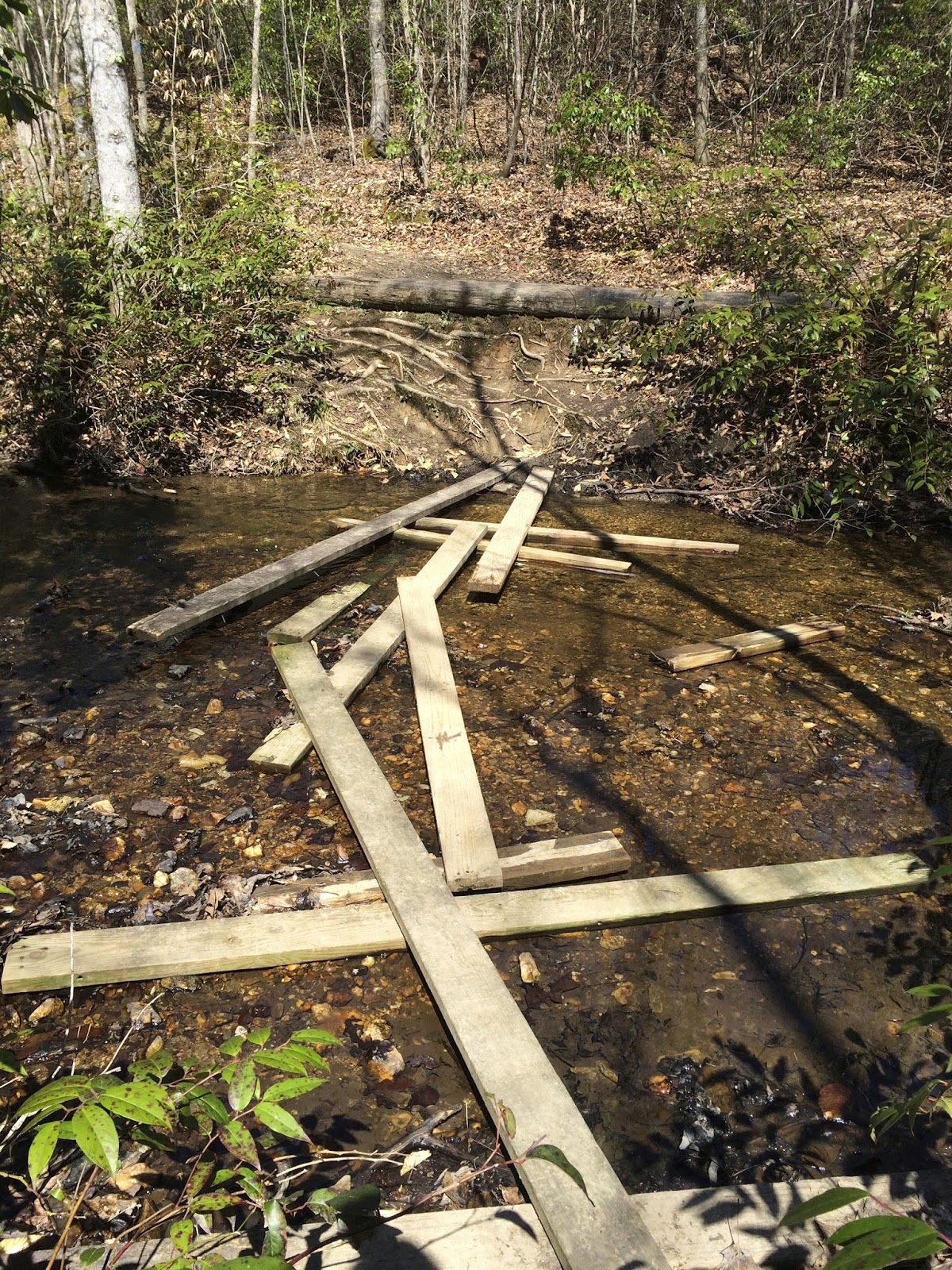
So, I went across the “bridge” and headed up the hill, following the blazes. At the top of the hill, I ended up in a parking lot… which looked very similar to the parking lot next to the lake. Hmm… I didn’t think the trail crossed the parking lot, so I headed back down the trail to see if I could figure out where I was supposed to be going. As it turns out, when I crossed the bridge, I missed seeing another blaze on the trail (the real one) that did almost a 180 around a corner from the previous blaze and took me back up the hill on the opposite side of the stream. The only complaint I have about this hike at all was that the blazes on the spur trails (to the parking lot, the lake and Browns Mountain) were all exactly the same blaze as the main trail, so while it was built as one big loop, it was fairly easy to get “off trail” from following the wrong blaze. Anyway…
There were a few more small stream crossings, these with bridges still intact – in the background you can see one of the many large trees that were down throughout the trail.
Over the river and through the woods and then I saw my favorite sign of the day…
Not quite the Ragnar 1 mile to go sign, but close enough!
I finished the hike at 17.85 miles in 6:14 which means an average pace of 20:59, which is considerably faster than the week before, but this trail had much shorter elevation gains and losses. Around mile 16, my knee started to hurt a bit and it hurt the rest of the night, but after some good rest, it was back to normal and I think it’s just going to take some more time to get my endurance back up since I’ve had a (fairly) lazy winter. The physical therapist told me that as long as the pain is gone within 24 hours, we’re in good territory, so with that, I’ll start thinking about what to take on my next 18 mile hike!
Trailblaze Challenge: Crowder’s Mountain 15 mile hike
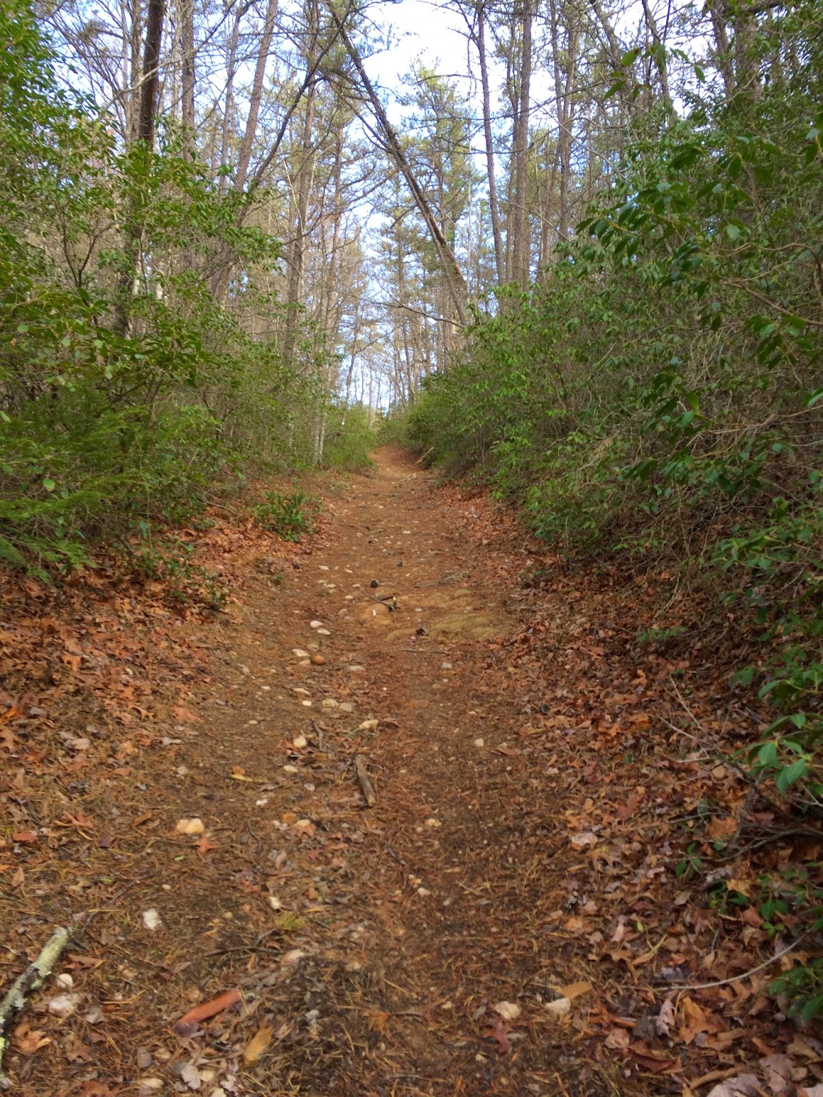
Last weekend was my second voyage to Crowder’s Mountain as part of this training cycle and this time we were scheduled to hike the other trails in the park for a total of 15 miles. Unfortunately with my previous commitment to the Elizabeth 8k, I wasn’t able to join the group hike, so I went on Sunday with one of my friends and we made the trek in 5 hours and 41 minutes for an average pace of 23:05 per mile. There were a couple of miles that we stopped to check out the scenery, so I think it was a good first attempt at a long distance with some pretty good climbs thrown in as well.
We started at the Park Office and followed Turnback Trail to Pinnacle Trail, then onto Ridgeline trail which goes all the way to Kings Mountain State Park in SC, but we stopped about .5 miles from the SC border at a picnic area to have lunch and then turned around to head back. For most of the trip, we didn’t really see anyone, except as we got closer to the bouldering area where more people were hiking, though we didn’t actually see anyone on the rocks.
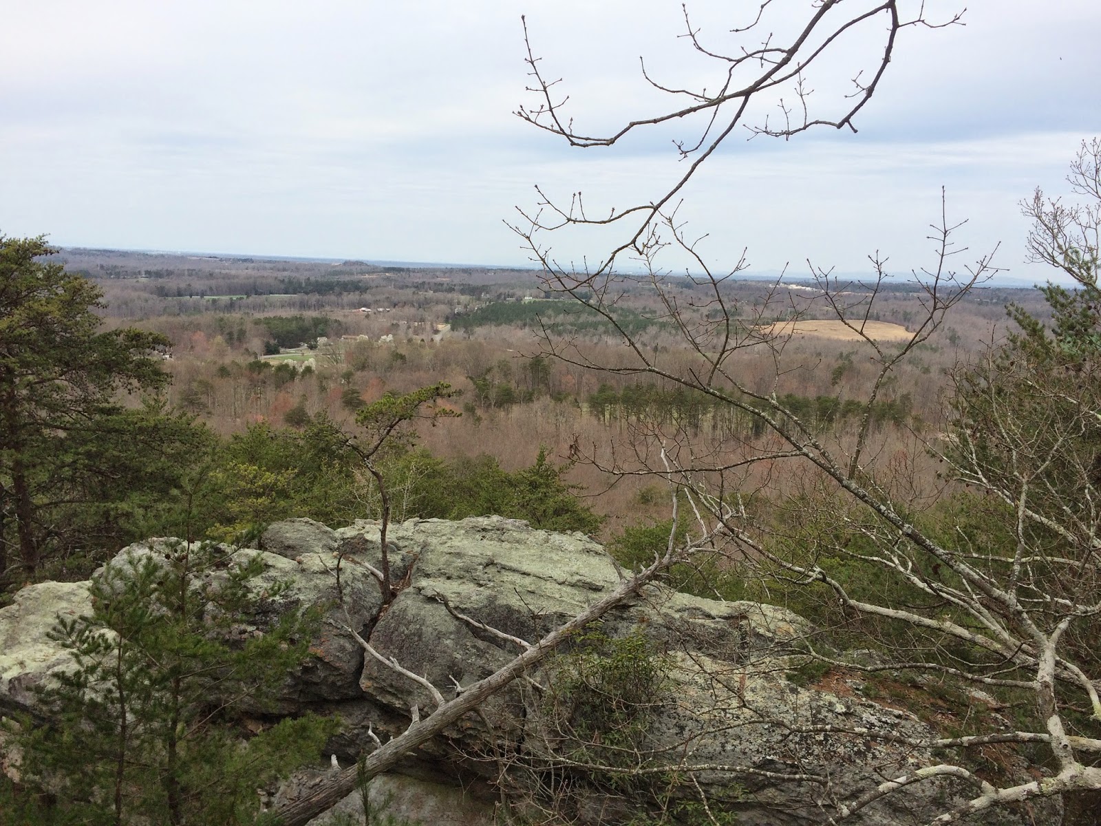
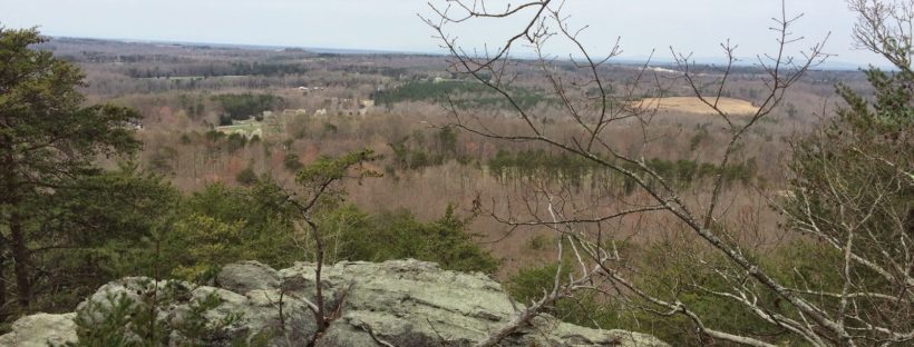
Not a whole lot to see from the top of this trail, but we did pass some farmland and it was definitely a less traveled trail than the one I did previously where you can see the skyline of Charlotte.
One of the bouldering rocks – it even had a metal clip already attached at the top.
I’m so tiny! This is the view from the top of some of the rocks and then I went down below to see if there was more of a path (there wasn’t).
I tried out my new hiking boots (Keen Targhee) for this hike. When we stopped for lunch at the half-way point, I changed into my trail running shoes since I was starting to have some foot pain in my heel and a little in the pad of my foot. I definitely want to try out some inserts, but it wasn’t a bad distance considering this was only the second time I’ve ever worn them.
It’s a little disappointing, though not unexpected, that there isn’t more to see on the trails yet. I’m starting to see glimpses of green coming on the trees, but most of the trails so far have been mostly bare trees and dead leaves, with some rhododendron thrown in for some green now and then. The weather was perfect for the hike, and in this area, it won’t take long before it will be too hot to do hikes of these distances, so I’ll take what I can get, knowing that all of this training should help me see some awesome views when I head out west in June!
Trailblaze Challenge: South Mountain
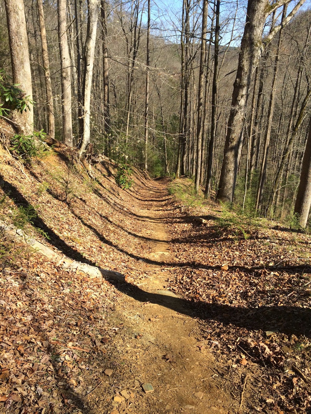
Last weekend, I did an 11-mile hike at South Mountain in Connelly Springs, NC. I’d never been there before, so it was a great introduction to the park which has over 45 miles of trails. Our travels took us from the Jacob’s Fork parking lot in a big loop up a lot of steep hills and then back down the other side. One of these days I’ll activate my actual GPS to see what kind of elevation change we do on these hikes, but for now I’ll just say it was steep! There were a lot of times I thought I was reaching the top of the hill only to realize we were still going up! It was a beautiful day for a hike, with the weather finally getting into the 40’s in the mountains and probably even in the 50’s in Charlotte. Our loop included Headquarters, Shinny, Possum, Horse Ridge, Lower CCC and Upper Falls trails. Several of the trails were horse trails that were fairly wide, but a lot of the time it was just single track through a lot of mountain laurel.

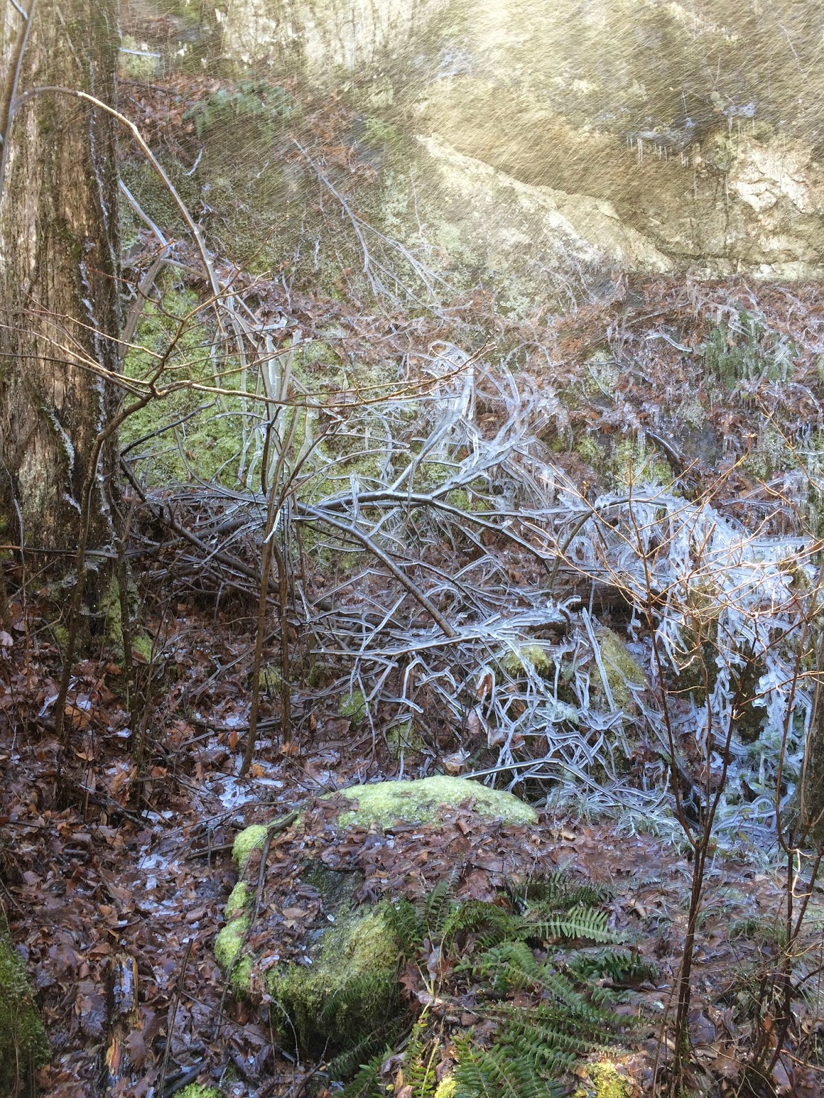
About a half a mile from the parking lot, my hiking partner and I took a detour to the top of Shoals Falls – lots of stairs and beautiful views of the water coming down over the rocks. This is definitely one of the most popular areas in the park and we saw more people in that 1-mile portion than we did through the rest of the hike. Even though it’s been warm for a few days, there was still a lot of ice at the top of the falls, which made for some cool photo opportunities (as long as you didn’t slip on the ice!) and made it look like it was snowing depending on which way you were facing.
Overall, it was a great hike and I’m excited to go back for our 22 mile hike in April to check out more of the trails – because of all of the mountain laurel it was already pretty green, but in a few weeks the trees should start getting more of their leaves and it will be even better!
Keep up with all my Trailblaze Challenge hiking adventures or donate a few dollars to help support my fundraising goal to raise $2,500 for Make-A-Wish!
Trailblaze Challenge & Crowder’s Mountain Hike

A few weeks ago, I ran across a Make-A-Wish Trailblaze Challenge information session listed on the REI website and signed up to see what it was about. Last year I saw a billboard with their website on one of the main highways in Charlotte, but by the time I saw it, the challenge had already passed and honestly, I kind of forgot about it until I saw it again on the REI website. So, I signed up for the information session and learned that challengers would be taking on a one-day, 28.3 mile hike on the Appalachian Foothills Trail in May. Once I got the confirmation that I didn’t need surgery on my knee, I signed up!
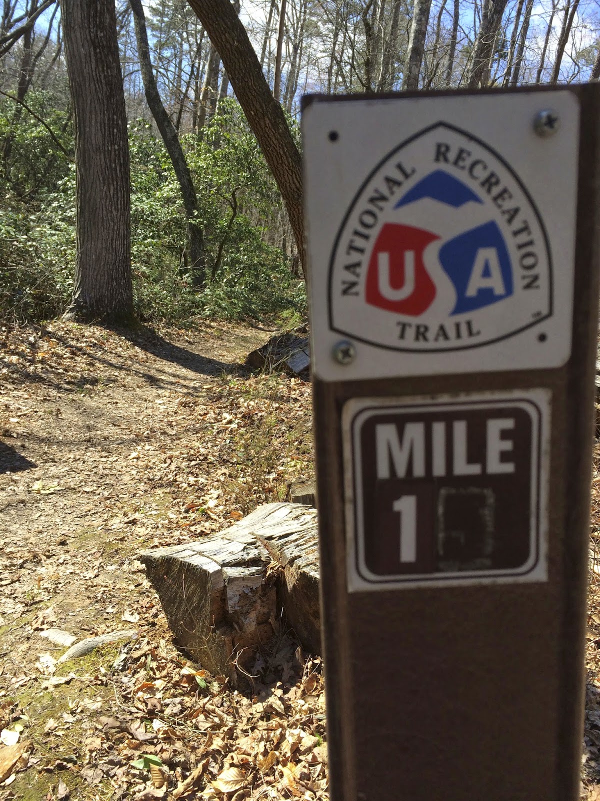
We got a training plan to help us ramp up our mileage and it’s very similar to a running plan – we’re expected to do 3-4 days of short mileage walks and on the weekend we’ll do a longer group hike. Our longest training hike will be 22 miles three weeks before our event and we’ll be exploring a lot of different trails within a few hours of Charlotte. We’ve had two training hikes so far and last weekend we did 4.5 miles at Crowder’s Mountain, about 40 minutes west of Charlotte. It got up into the 40’s and was sunny so it ended up being a great day for a hike. Starting from the Linwood Road Access, we started on the Backside Trail, then went to Crowders Trail and finished on the Rocktop Trail (or we were supposed to). We started in a large group and quickly separated based on pace as we started out going straight uphill. For awhile I ended up walking by myself and then I would randomly catch up to some folks and after we got past the scenic outlook (below) we had to do some scrambling over some rocks and 3 of us ended up together. We came to a fork in the trail and while there was a sign that gave us directions, there weren’t any blazes, so we headed in the direction of the parking lot. After about a mile, we caught back up to our pace leaders and realizes that we must have taken a wrong turn. After looking at the map again, we probably ended up walking farther than the rest of the group, but we also probably cut out some of the elevation – we ended up following the Tower Trail instead of staying on the Rocktop Trail. I guess this just means I’ll have to go back again to check out the overlook at the towers!

If you squint really hard, you can see the Charlotte skyline
As part of of the Trailblaze Challenge, I’m raising money for the Make-A-Wish foundation to help grant the wishes of children with life-threatening medical conditions. I’d love to have your support in my efforts and any amount you can give is greatly appreciated!
I’ll be creating a special training shirt for this challenge and anyone who donates $25 or more by March 1 can have their name or a short tribute message included on this shirt. Making a donation is easy and secure through my personal page. You can also join me in raising funds and spreading the word by simply forwarding this link along to your contacts – you never know who might be able to help and any gift is another step toward granting vital wishes.
Thank you in advance for supporting me in my Trailblaze Challenge. With your help, I can hike 28.3 miles and give children the gift of hope, strength and joy!