Tourist Time: Mount Monadnock

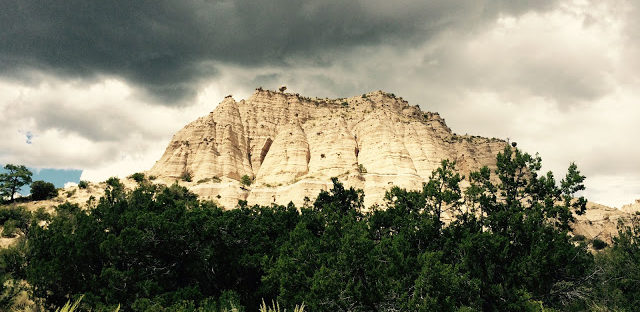
After finishing the Drummer Hill race, I headed about 30 minutes southeast to Mount Monadnock to do a summit hike. I had read about the hike in my planning to head up to New England and knew it was going to be a tough hike, but since i stopped the race at 20k, I figured I would be okay.

When I got to the entrance, the gate attendants told me that they were expecting an afternoon storm, so I made sure I was keeping an eye on the sky as I as I was hiking. Based on the information I had read online, I was planing to do a loop, taking one route up and a separate one down which would theoretically be easier – after hiking both, I definitely agree on the suggestion and was very happy not to have to go back down some of the rock climbs I did on the way up!

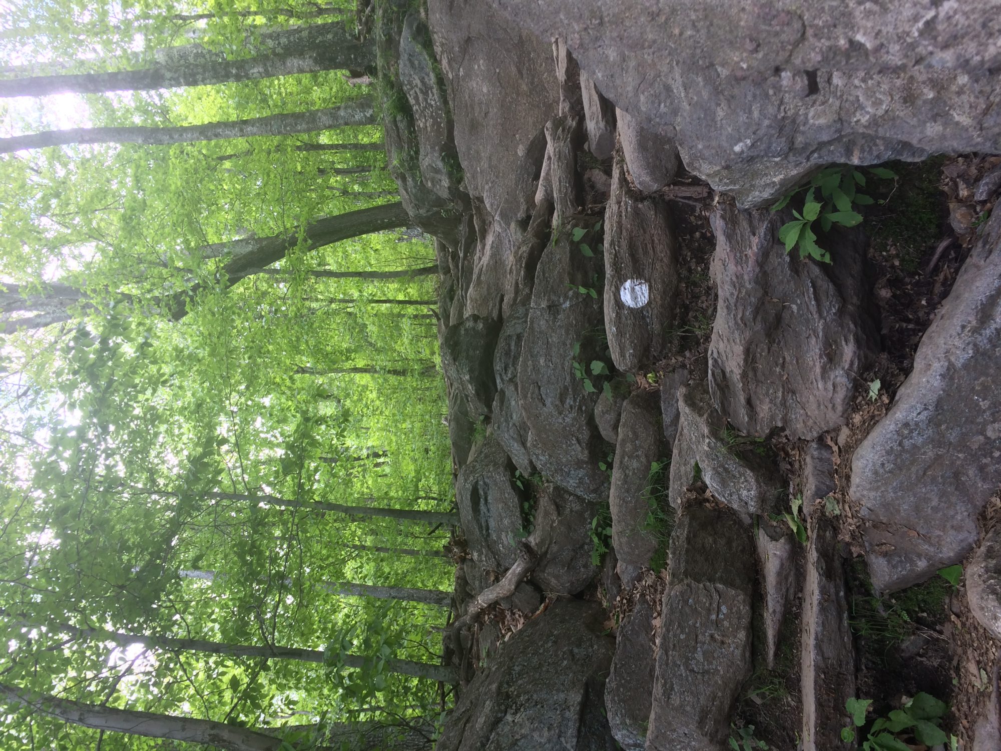
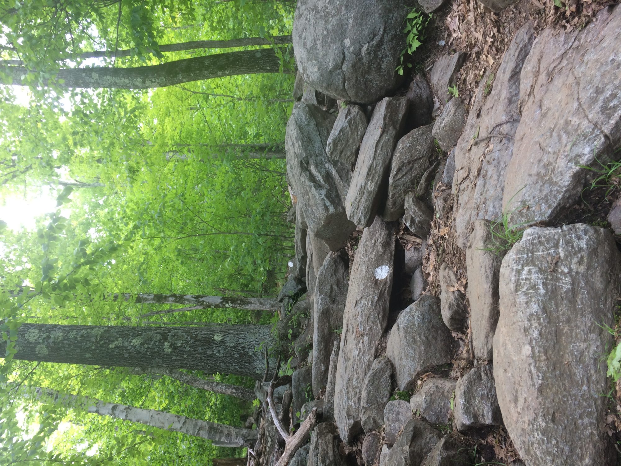
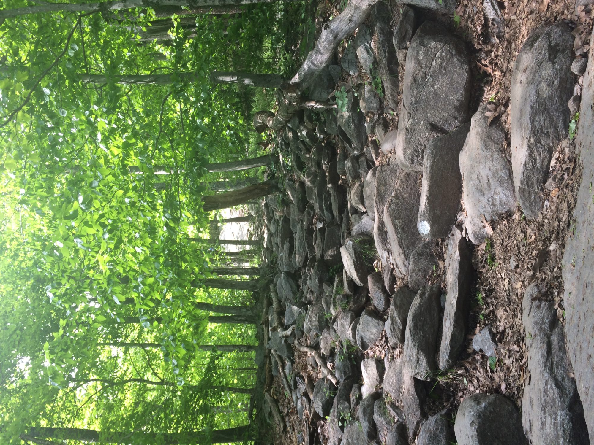
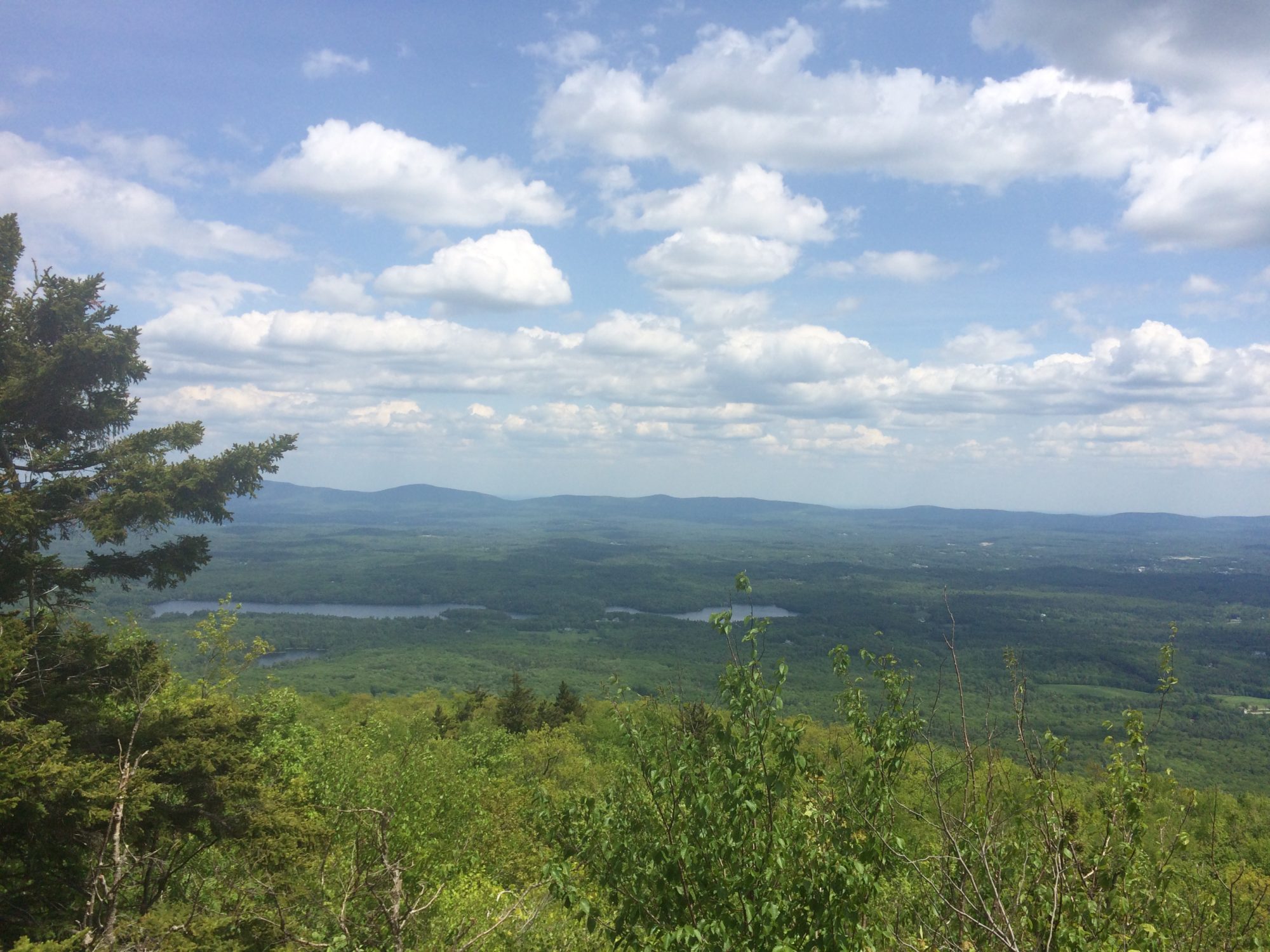
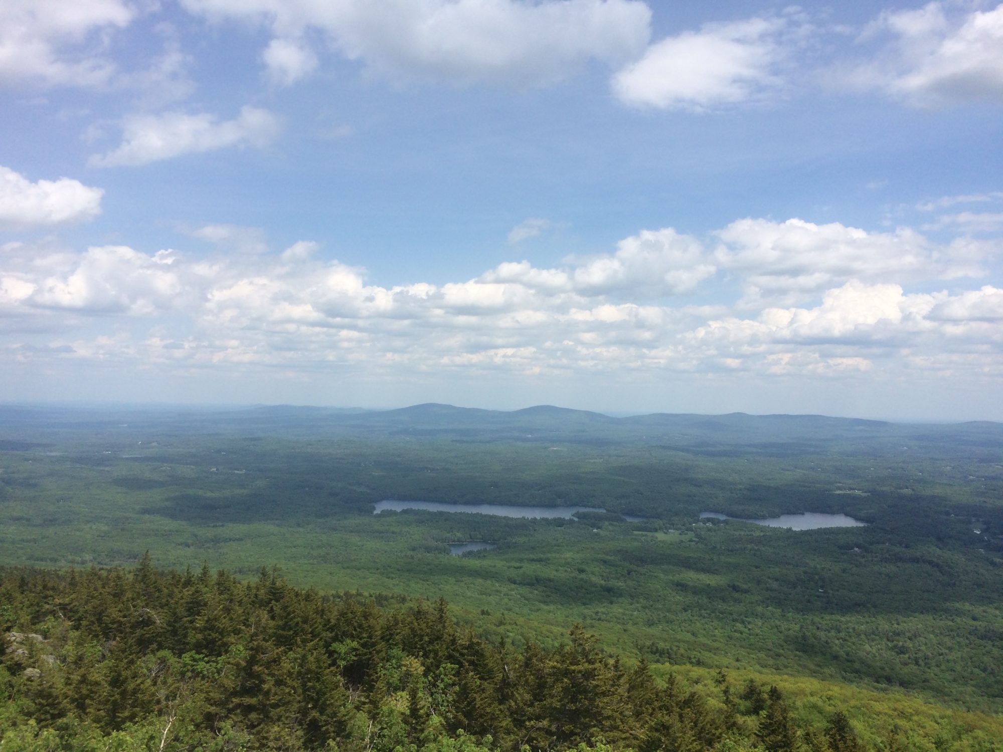
From the beginning of the hike I knew it was going to be a tough hike. Even on the relatively flat portions at the start were strewn with rocks which made for slow hiking to make sure I wouldn’t turn an ankle.

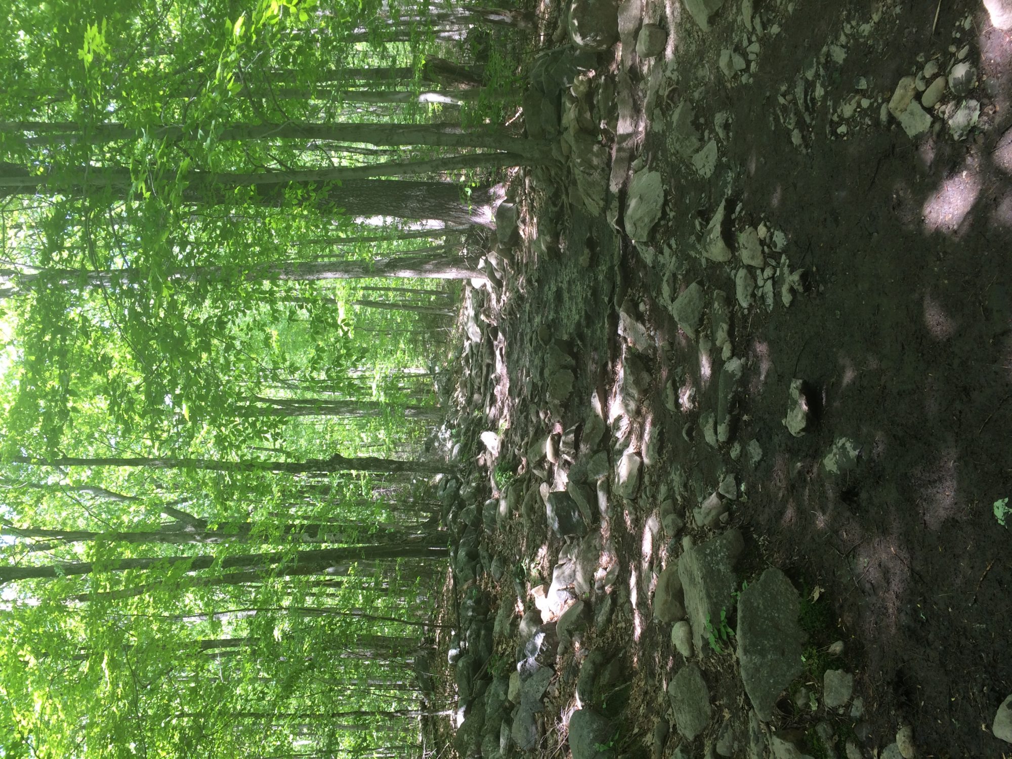
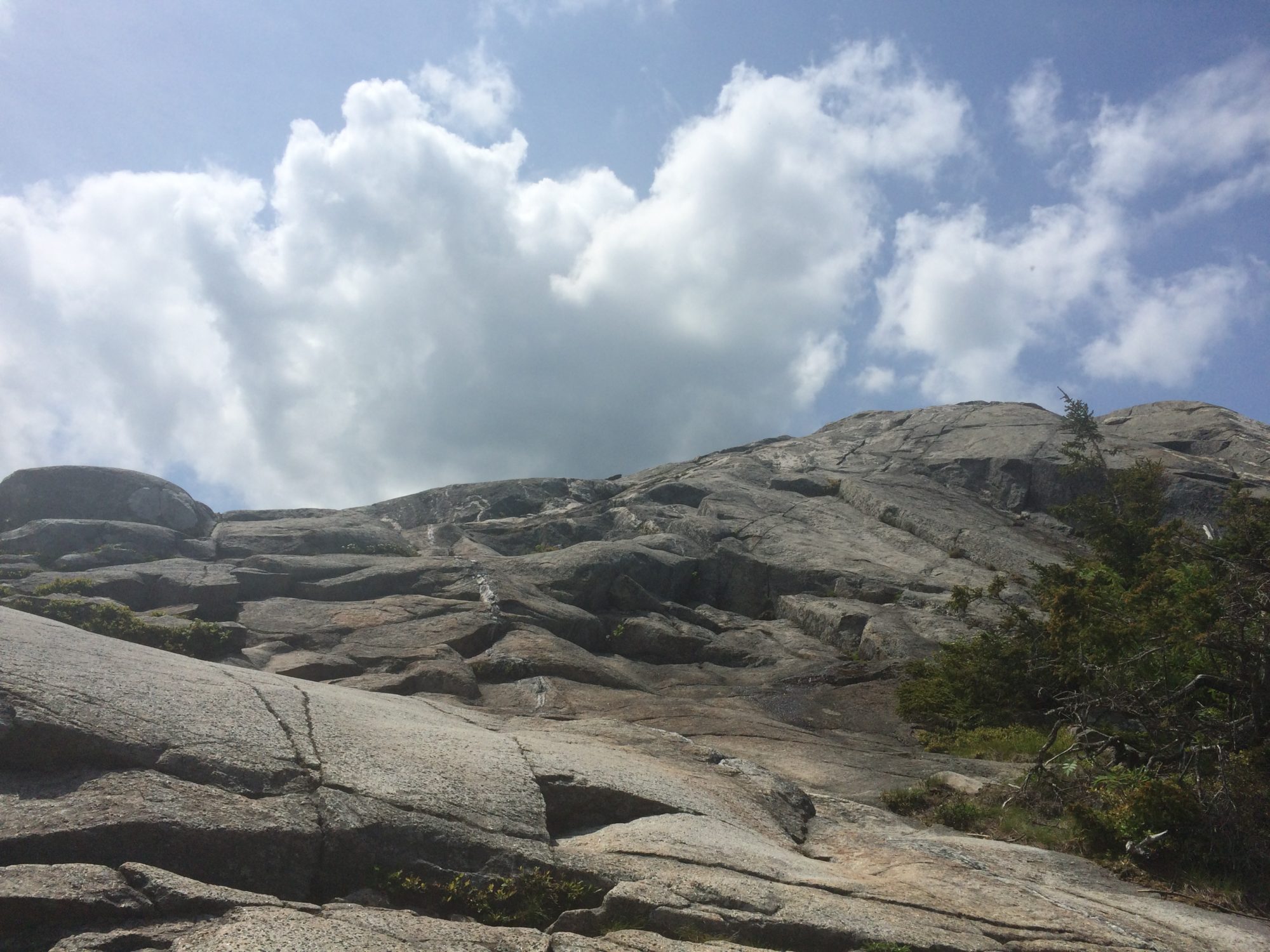
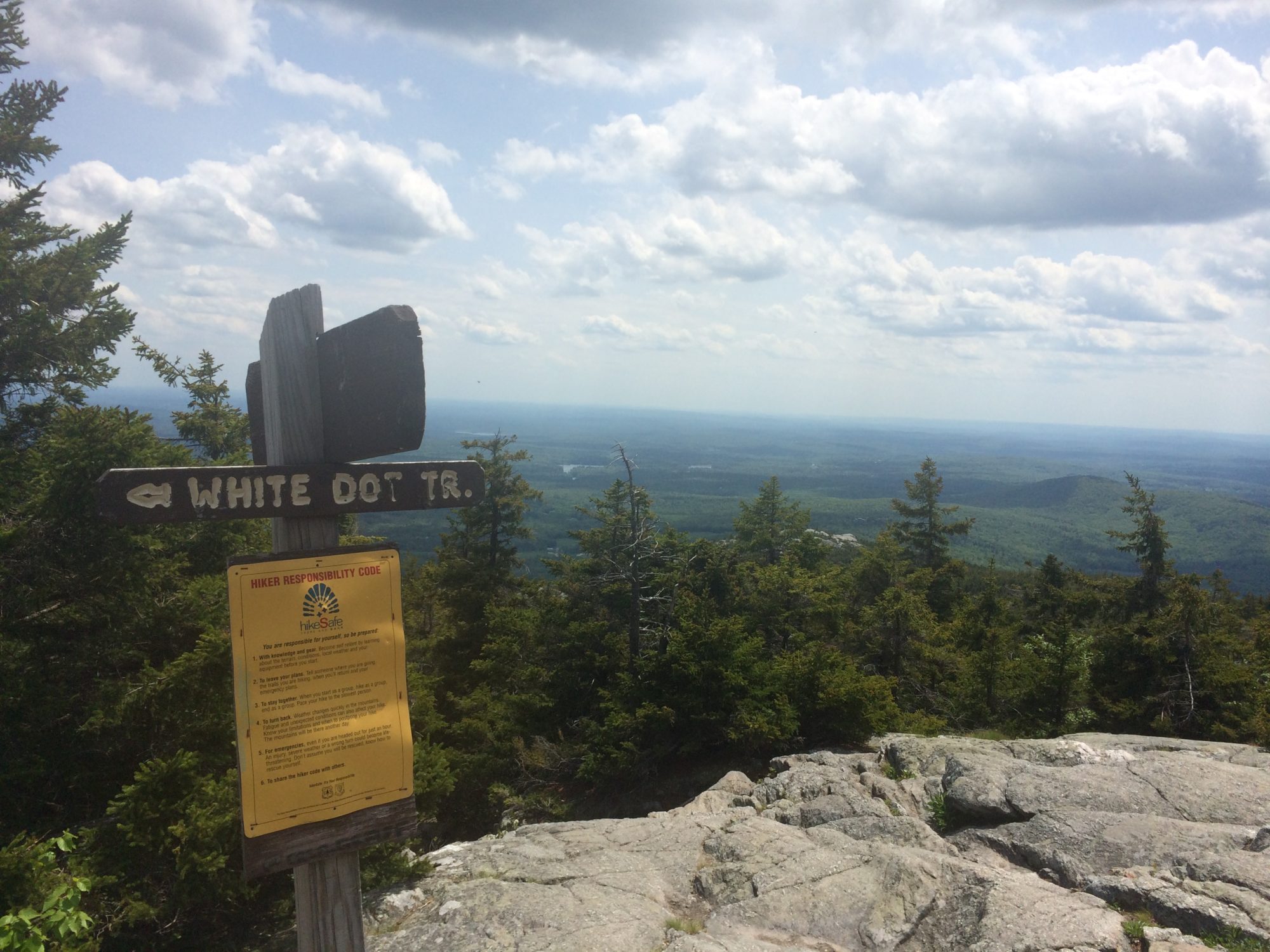
The trails were well marked with white circles and though it was a tough climb up, scrambling over lots of rocks and boulders.

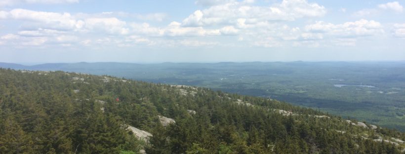
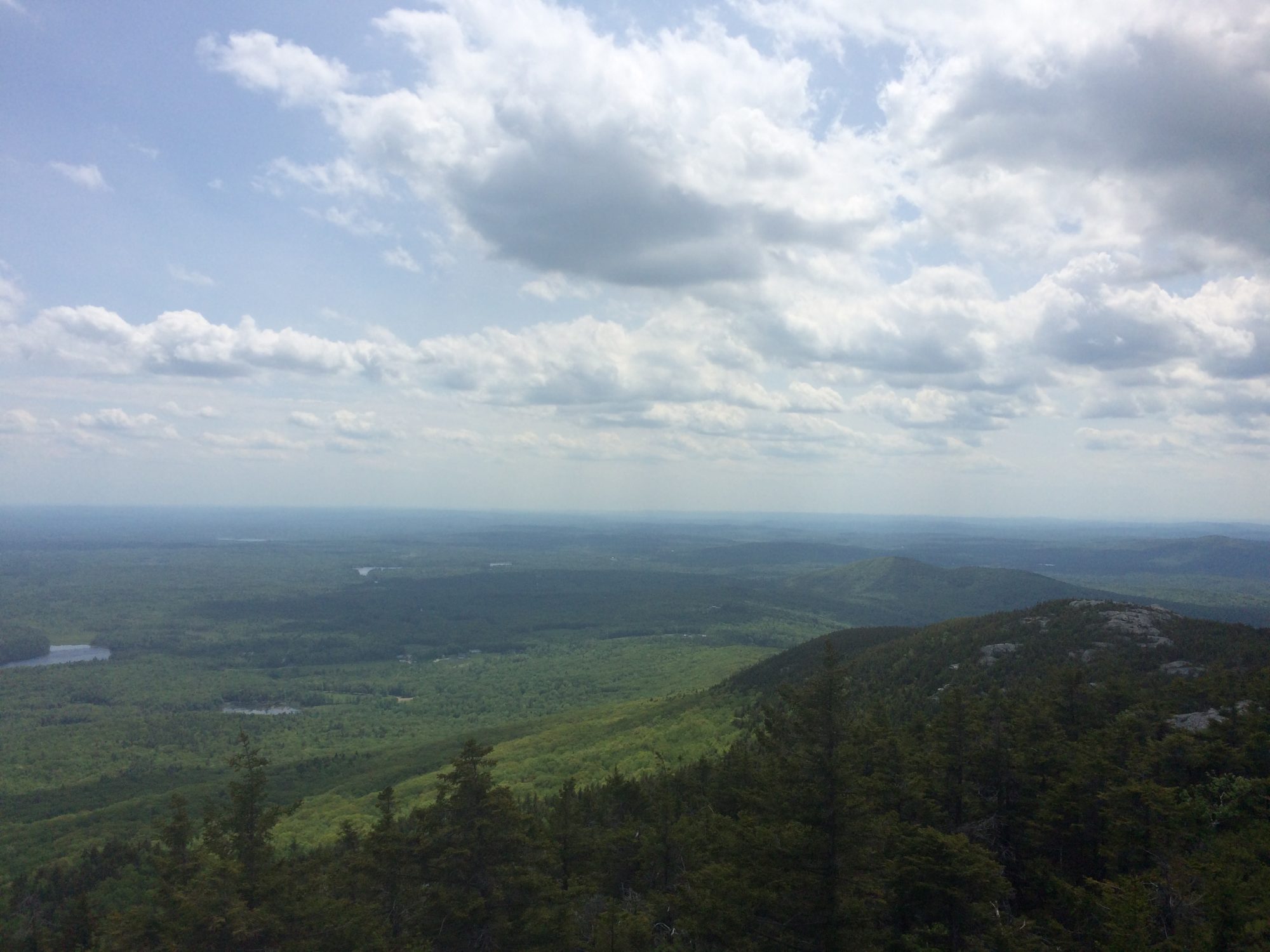
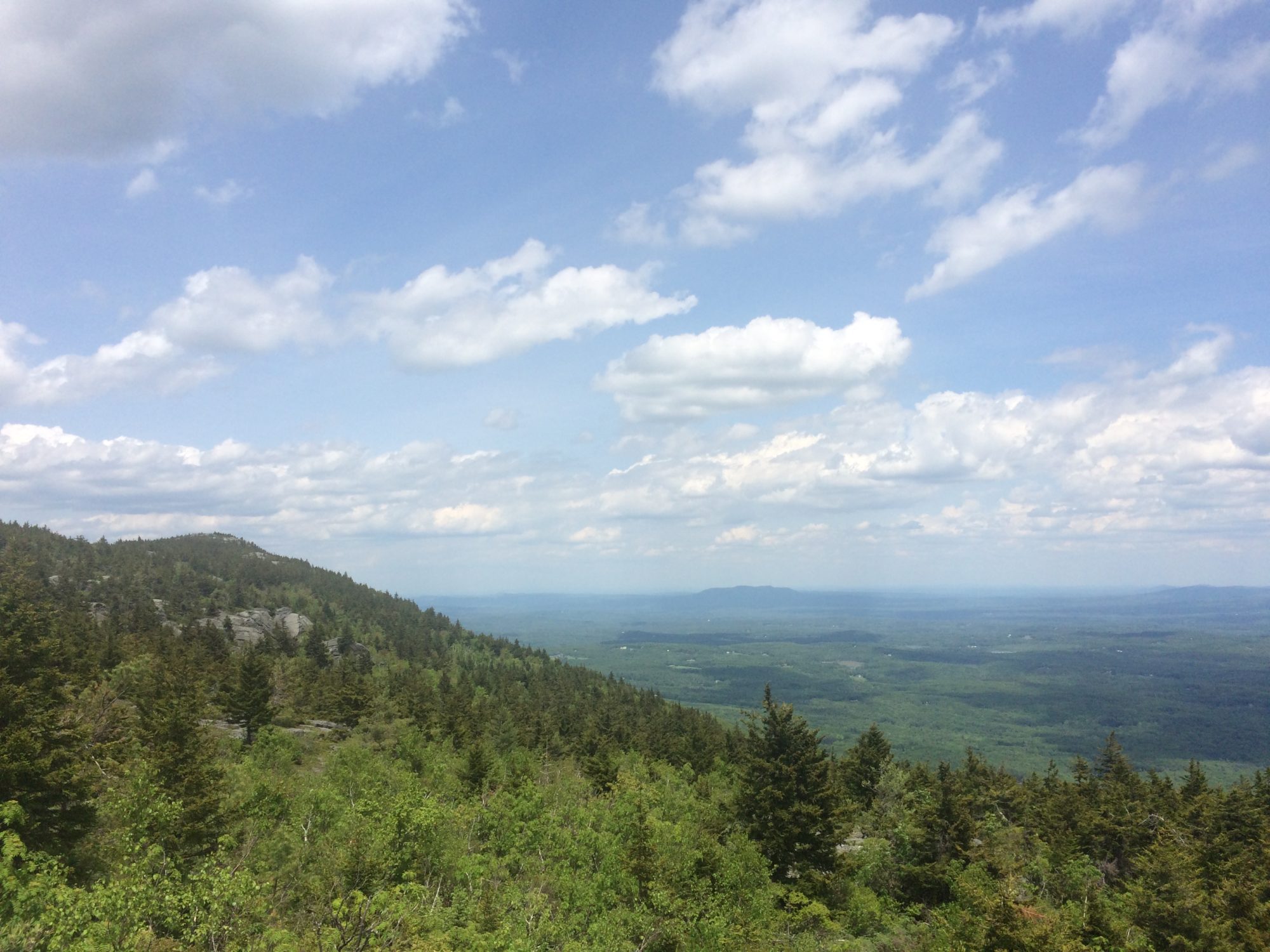
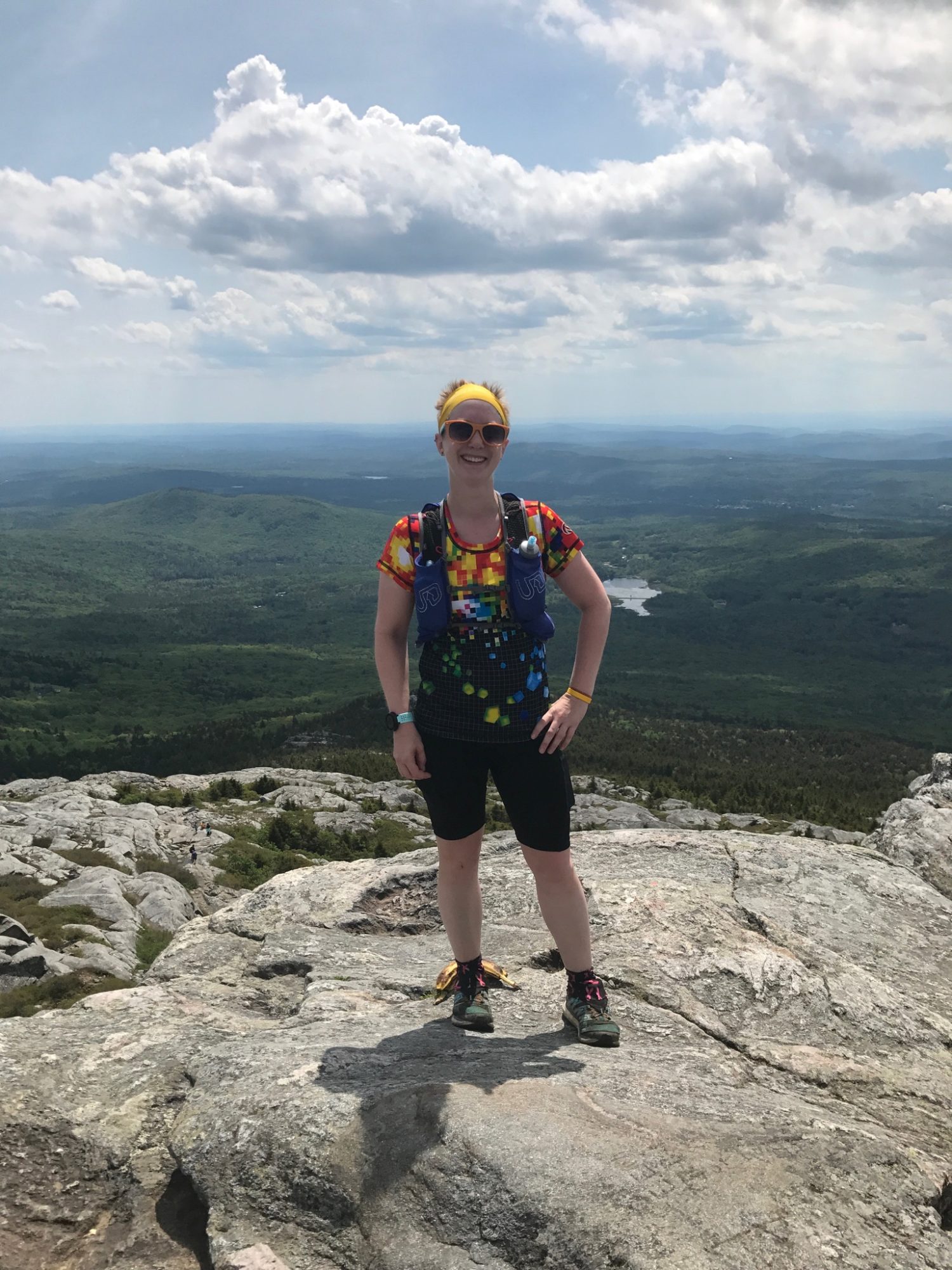
I took my time and made sure to take lots of pictures as I was climbing and then even more once I got above the tree line.

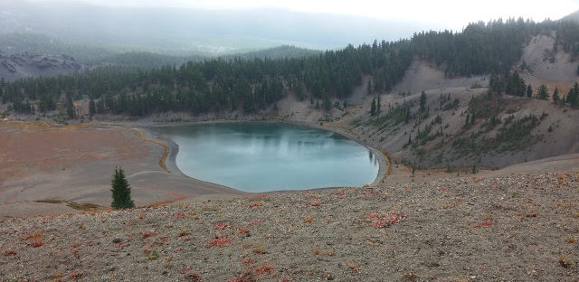
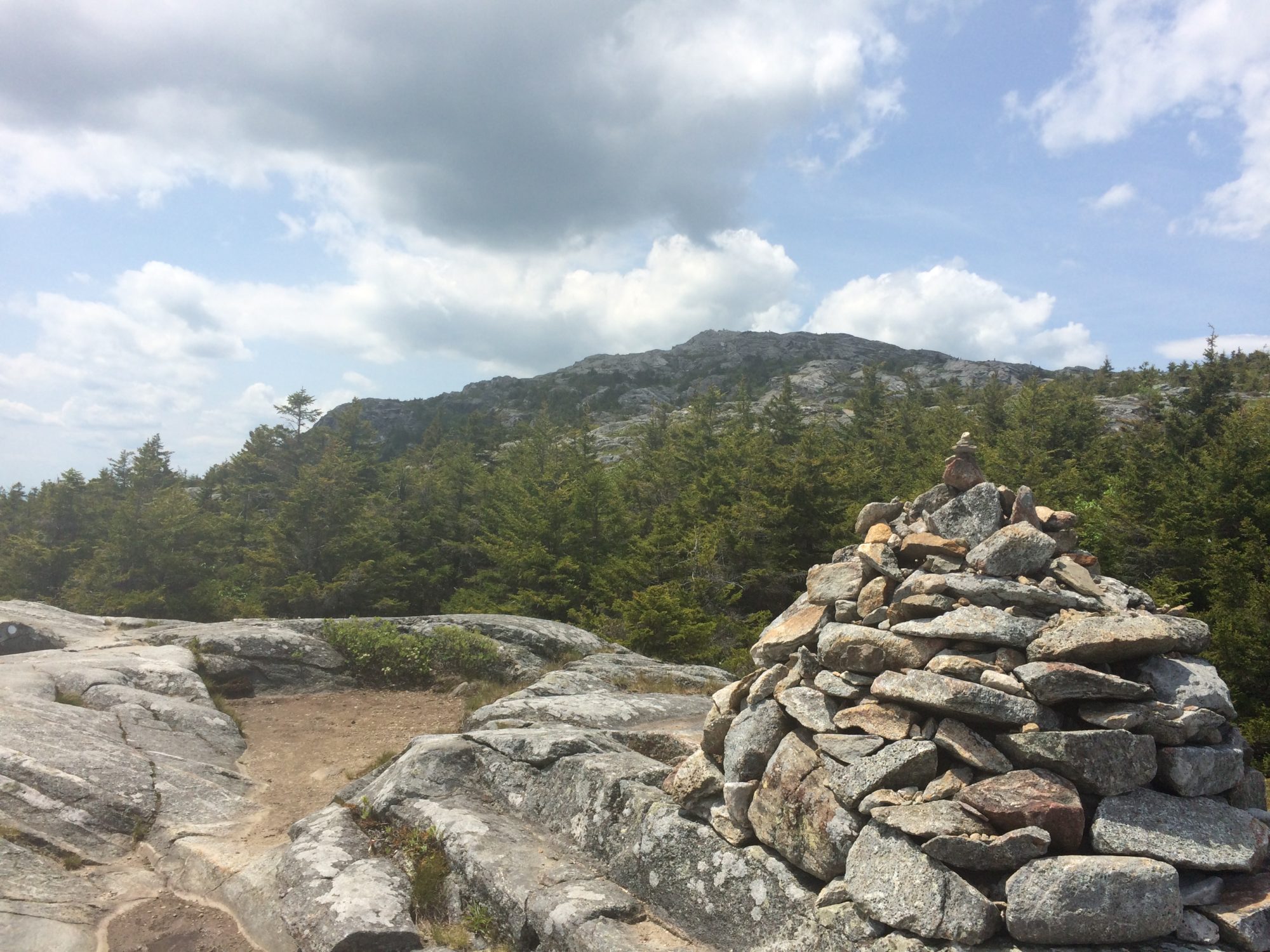
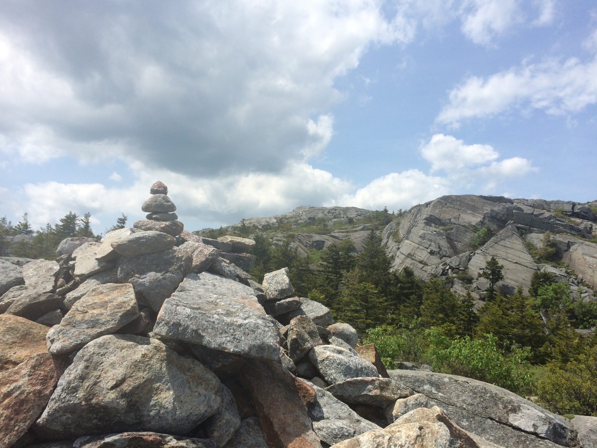
following the cairns to get to the top 

you can just see the very top in this picture, still a long way to go!
Unfortunately my phone died before I made it to the very top of the mountain, but I found some good samaritans who were willing to take a picture of me with their phone and send it to me so that I could have a memento of the climb.

I figured my phone just needed to be charged as I’d had this happen before where it said it wad dead, but actually just needed a kickstart of electricity before it would jump back up to 50% again. So I stowed my phone and just worked my way back down the mountain. Eventually I made it to where the trail split and headed down the new trail. There were a lot more steps built into this side of the trail, so while it was still rough my knees and quads, it felt a lot safer than the scrambling I had to do to get up the other side!

On the way down there were fewer people around, but as I was climbing down some bigger rocks with a guy following close behind me, I saw a snake sunning himself on the rocks and the guy behind me stopped to Snapchat with the snake.

After getting back to my car, I tried charging my phone with my portable charger, but it wasn’t turning back on, so I asked the woman working at the gift shop if I could borrow an outlet and tried that for about 15 minutes, but my phone still wasn’t working, so I went to the next plan – written directions back to Boston! I wasn’t actually heading to Boston, but I knew I needed to go south to get to Providence, RI, so I figured I could follow the directions until I found a gas station and hope they still sold maps. After about an hour of driving, I recognized one of the cities from my snooping around prior to the trip trying to decide on a hotel location, so I took the exit and was officially on my own to navigate the rest of the way. Luckily it wasn’t too long before I came into a more populated area and pulled off to find a gas station. At this point beyond finding a map, I also needed to find a Verizon store since my phone still hadn’t turned on. Amazingly enough, when I stopped at the first gas station I saw, I was only a few blocks away from a Verizon store and of course, when I told the ugly what happened and how my phone wouldn’t turn on, he got it on within seconds! But, at least now I know the trick of how to fix the issue for when it happens again (spoiler: it’s happened multiple times since then).

After the almost half marathon in the morning, hiking in the afternoon and then driving a few hours, I was ready for an early night in Rhode Island, but of course, I had another race the following morning to check off state #28, Massachusetts!

Thanksgiving #optoutside

Today is a gorgeous day to get outside, so this morning I took the dogs out to Anne Springs Close Greenway to wander around some more trails. We started on the Haigler Loop around the Lake, then took the Kimbrell Loop to Timberline, then followed the Blue Star Trail back to the Lake and took the long way around the Wagon Loop to get back to the car. We probably covered about 5.5 miles total and took lots of pictures!

I hope everyone has a great Thanksgiving!

Tourist time: Oregon days 5-6

After the race on Saturday, I spent most of the rest of the day just laying around not wanting to do anything. A soak in the hot tub at the hotel and a nap definitely helped, but combined with the adventures from the previous week and a half, I was more than happy to just have a lazy night watching college football.

We did add one more waterfall viewing to the trip with a short drive to Salt Creek Falls. It was about 20 minutes east of Oakridge and was easily accessed via car which was the most important part. There was a short walk to the top of the falls.

From the top of the falls, there was a path that went further away so that you could see the whole 286′ waterfall.

After the waterfall was dinner at Stewart’s 58 drive-in which I can’t recommend enough. Part of it could have been that I was starving from the race, but it’s the highest rated restaurant in Oakridge, so something is definitely working for them. I ordered a chicken sandwich, fries and a milkshake. The portions were huge! The sandwich was easily bigger than my hand and was absolutely amazing. I took the milkshake to go (think giant to-go cup) and had to give up on finishing it after about an hour because I was so full. I would definitely recommend stopping there if you’re coming through Oakridge.

Unfortunately, my time in Oregon was coming to a close and my flight which was supposed to be at 10pm on Sunday was cancelled and I got put onto an 11am flight instead. Luckily I was able to get it switched to the 1pm flight since I didn’t know about this switch until the day before. Thankfully I’m a planner and always check in early for my flights because I never received any type of notification from Orbitz or US Airways that the flight that I had booked had been cancelled and they decided to put me on a much earlier flight. 

I ended up missing out on the Portland Saturday market since I was leaving so much earlier and ended up having to spend an extra 7 hours traveling (yay 2 hour layovers), but I got home around midnight on Sunday and was able to spend all of Labor Day unpacking, napping and attempting to get ready to go to work the rest of the week.

With my second westward adventure coming to a close, it was time to look forward to another race the next weekend – Great Smoky Mountains half marathon!

Tourist time: Oregon day 4 – Wandering the coast

One of the things I knew I wanted to do was to see the sunset on the west coast, so after the waterfall hike, we drove for a little over 3 hours to Seaside, OR. Originally the plan was to stay in Manzanita, but after a less than ideal motel in Cascade Locks and two tough days of hiking, splurging on a hotel with a hot tub was an easy decision. After a good Italian dinner, we walked to the beach. There were a few folks who had fires going on the beach, which is definitely not something you see here on the east coast. The whole atmosphere of the west coast is different than the east – the weather is cold and very windy and the water itself is really cold, so even though it was the first week of September, there weren’t any people in the water. I braved walking in up to my ankles and that was plenty deep enough for me – it was cold! The sunset did not disappoint.

Friday was a slow start, but the only plan for the day was to wander the coast checking out some of the main attractions and then head onto Oakridge for the race on Saturday morning. The first stop was Haystack Rock at Cannon Beach.


Shortly before I took off for this trip, I ran across the New Yorker article that talked about how we’re way overdue for an earthquake large enough to devastate the Pacific northwest and if / when it comes, if you don’t see the warning signs before the actual earthquake and you get caught near the coast, it will already be too late for you. So, needless to say, when I saw this sign, I had to grab a picture.


From Haystack Rock, it was a short trip to Neahkahnie Mountain where we took the south trail to the top for an amazing view of the coast. 


The trail was only about 3 miles round trip, but the elevation change (around 840′) was enough of a workout after the last two major days of hiking. Since it was early afternoon, we grabbed lunch in Manzanita and I would highly recommend Left Coast Siesta. I wasn’t sure about Mexican food in the Pacific northwest, but it was one of the best meals of the trip. Plus, who can resist a place that calls the west coast the left coast! 

The last stop on the coast was the Cape Meares lighthouse. You have the option to climb up to the top of the lighthouse, but there was a group already up there and a line for the next group, so we passed on that option. 

Instead, opting to wander around a few of the trails and check out more great views of the coast.

The rest of the day was spent driving to Oakridge, which ended up being around a total of about 6 hours since we stuck to the coast until around Newport, and then getting organized for the Hardesty Hardcore Saturday morning!

Tourist time: Oregon day 3 – Hiking for waterfalls

This was the day I was looking forward to the most on this trip – the plan was a 13.5 mile hike to see 7 different waterfalls and while it ended up as a 16.5 mile hike, the waterfalls were amazing! The trail starts at the Eagle Creek trailhead and is an easy hike that does have some elevation gain (about 1,700′ from the start to 7 mile falls), it’s fairly gradual and the scenery more than makes up for it! The moon was still out and there was still some fog in the trees at the start of the hike, but certainly nothing like the previous day at South Sister.


Some sections of the trail were just a few feet across with cables to hold on to, with varying degrees of drop-off on the other side.

Metlako Falls
We actually missed this viewpoint when we first came through, but knew that we had missed it, so we kept an eye out on our way back and it was really easy to see the second time around. Unfortunately, apparently I didn’t take any pictures of these falls. I must have been too spoiled by all of the other amazing views from the day.

Punchbowl Falls
For this view, you’ll actually need to take a spur trail down to the bottom of the falls, which added to our initial estimate of 13.5 miles – I’d say it was probably half a mile or so down to the bottom to see the falls.


Loowitt Falls
This one was the farthest away from the trail, but if you could ever get over there, it looked like a great pool to swim in under the main waterfall.

High Bridge
Sure, it’s not a waterfall, but it was a fun bridge to cross in the middle of the hike and it definitely lives up to its name, though I’m not sure it translates as well in pictures.

The high bridge is 3.3 miles from the trailhead and we were (again) following a less than ideal map, so after hiking for awhile, we got a little concerned that we must have missed the correct trail, so we did a backtrack about half a mile to consult another map before deciding we must have been on the right track all along and then met someone who told us we were just a mile or so from the next waterfall.

Skoonichuk Falls
This one wasn’t actually on our map, so it was a nice surprise addition to our hike.


Tunnel Falls
This was the waterfall that made me want to do this hike. What could be better than hiking behind a waterfall? The trail starts out by going behind the falls before coming out the other side.

After you come out the other side, you can feel the immense pressure of the water coming down over the falls and you’ll definitely get hit with the mist. Because of how the trail follows the mountain, I couldn’t even get the entire 120′ waterfall into one picture, but you can see how small the person looks as he takes the trail that winds behind the falls. 

We also made our way down to the bottom of the falls and, again, you can see how small the people are walking on the trail.

The climb to the bottom of the waterfall was a little treacherous, mostly climbing / sliding down a scree field, but I went slowly and it was actually a lot easier climbing back up than I was expecting when I first looked at it.

Twister Falls
Not far down the trail, we came to these falls and it’s easy to see how they got their name, with the water twisting around the rocks.


7 Mile Falls
We finally made it to the turnaround point at 7 mile falls, even though it took us over 8 miles to get there!

The highlight of the hike was absolutely the Tunnel Falls and I would recommend this hike just based on that one waterfall – the fact that you can pack 7 into one day hike is amazing. Oregon certainly has an abundance of waterfalls to see.

Next up – touring the Oregon coast!

Tourist time: Oregon day 2 – South Sister Mountain

 It started as a request – I want to do a summit hike – which turned into a challenge – then let’s go for 10,000′ – which is how we found ourselves just at just under 9,100′ with 40+ mph winds trying to push us off the top of the mountain and rain, sleet and snow threatening to freeze us where we stood… but let’s go back to the beginning.

After a 45 minute drive from the hotel in Bend, we got to the South Sister trailhead around 8:00 and it was only 45 degrees outside. The weather was foggy as we got our gear together and after making sure I had my trekking poles, we set off for a 12-mile round-trip hike to the summit. The initial climb had us trekking through the forest and while there were no blazes on the trail, it was really easy to follow because there was only one path. 

After being passed by a group of three 20-somethings who were all wearing shorts and t-shirts, we joked that we clearly came from the south because we were not used to the cool (cold to us) weather. We saw them once more before we exited the woods after they did a little rock climbing off trail, but we quickly lost them after that. The trees were massive and moss was growing on virtually every surface.

After the woods, we came to an exposed area where the rain and wind whipped against us and made the views off the mountain virtually nonexistent. 


The fact that it was raining really wasn’t the issue, but the wind was enough to steal whatever warmth generated from the hiking. This is about the time we passed our first person who was coming down the mountain. All he could say that it was too cold and he had to turn around. We kept moving and eventually found a spot with some tree coverage to eat lunch and tend to some blisters before continuing up the mountain. 

The terrain on the first 3-4 miles was fairly well-groomed trail with some roots and large rocks, but soon after we passed our second group coming down the mountain, we got into the really rocky trail. The second group also had to turn around because of the weather and said they made it to probably about 8,400′ before heading back down. They did assure us that the trail was really well marked and we shouldn’t have any problems following it as long as we were prepared for the cold and rain. At this point, the fog and rain which had started to dissipate came back in full force and you could see the wind blowing it over the sides of the mountain. The third group we came across said they made it to about 8,600′ before turning around. On we went… up, up, and more up. I was really glad that I had my trekking poles for this part of the climb, and it’s actually the only reason I packed them for this trip at all. 

We got to a section that was a mostly a scree field with some good ankle-busting rocks mixed in just for fun. Since we could only see about 50′ in front of us, it wasn’t clear where the trail actually went and looking straight up from where we were, it looked like it was going to be too steep to actually climb. Not having an actual trail map (fail!) made us question whether we were at the right spot, and we could see a clear trail on the mountain to the right, so we went back down the trail and ran into another hiker. Unfortunately, it was his first time at the mountain too, so he wasn’t sure where we were either. All three of us headed back down a little farther and ran into a forth person who also had never been there before. We finally decided we must have been on the trail all along, so the three of us (the last guy turned around) headed back up where we just were and slowly made our way to the top. 

I was really struggling on this section of the hike. I could go about 5-10′ and then would have to stop and catch my breath and spent most of my time thinking about how cold I was. Besides the fact I was cold, I think my biggest issue was not taking in enough calories – all I had eaten on the trail was some Cheez-Its, an Uncrustables sandwich (awesome hiking food!) and a peanut butter trail bar – definitely not enough when exerting that much effort.

When we got to the top of that section, we found the three people that had passed us in the beginning of the trail and they looked absolutely frozen! One of them had wrapped a towel around their legs and they were all using extra socks as gloves. We wished them luck as they headed back down and stole their idea of using socks as gloves since we hadn’t brought any either. We had finally made it to the point where we could see Lewis Glacier.

We pressed on until we saw Teardrop Pool, but decided that we weren’t going to be able to see anything at the summit and we were both frozen, so we made the decision to turn around. By this point, I was using my trekking poles to help keep me steady as we stood at the top because the wind was so strong it was threatening to knock me over and the fog had turned into freezing rain / snow, so it was definitely not a pleasant place to hang out.

For as hard as it was to climb up the ankle-busting rocks and loose scree, it was even harder to go down. My legs were cold, my hands were cold, the wind was blowing rain into my eyes, so it was very slow going down the steepest section near the top. We stopped again where we had lunch and grabbed some more food which that made things a bit better, along with the fact that it was a much more gentle downhill from there on out. As we passed Moraine Lake, the weather had cleared up a bit again, so there was one last photo op before we high-tailed it back to the trailhead.


After making it back to the car, I got into some dry clothes and exchanged my hiking boots for sandals to ease the pain the new blister on my heel. The rest of the day was spent finding some food (a random restaurant outside of Bend where there were only 3 other people) and driving around the other side of Mt. Hood to Cascade Locks for the night. Once we got down to our starting elevation, around 5,500′ the weather had cleared up and we were able to enjoy it, at least for a little while.


The rainy weather caught back up with us and stuck around for the rest of the evening, so our trek to see the Bridge of the Gods wasn’t as exciting as I was hoping, but it was still neat to see where the Pacific Crest Trail crosses into Washington.


After a long day, it was an early night to get ready for an even longer hike the next day!

Tourist time: Oregon day 1 – Multnomah Falls

Tuesday morning (September 1), I flew from Albuquerque to Portland via Phoenix, which is a surprisingly long flight, and started on the second-half of my adventure – Oregon! The Oregon trip was thoroughly (overly?) planned as there were so many things I wanted to do while I was there and I only had 6 days to fit everything in! There was going to be a lot of driving on this trip, with every day having at least 2-3 hours and sometimes more depending on what was next. 

First up was a drive from Portland to Bend via the scenic route around Mt. Hood. The first stop was Multnomah Falls, about 45 minutes east of Portland. It was a good place to grab lunch and stretch my legs with a short hike. It was fairly cool, so I was just dressed in jeans and a t-shirt, which was regrettable very shortly into the hike, an uphill jaunt to the top of the falls. One of the best views of the falls is easily accessible from visitor’s center, so you wouldn’t need to hike if you didn’t want to.

The good news about the hike to the top is that there are switchbacks to help cut down on the steepness, but the bad news is that there is a ton of them!

Despite what the sign says, there were definitely more than 11!
 
The path is also paved, which makes it a little bit of an easier walk, but I was still pretty slow during the hike and was regretting the choice of jeans as the trail kept going up.
 
 
The view from the top of the waterfall isn’t nearly as exciting as the first view from the visitor’s center, but you can see just how far you hiked (the upper falls are 542′ and the lower falls add another 69′) and how small the parking lot is. 


You can also get a good view across the Columbia River to Washington.


After the falls, the rest of the drive down to Bend was fairly uneventful. There was a ton of fog around Mt. Hood, so it was hard to see up close, but after exiting the national forest, I got a great rearview mirror look at the top of the mountain rising out of the fog. Next time I head to Oregon, I will make sure to add an actual trip to Mt. Hood to the list! There were a few more mountains dotting the horizon on the way to Bend, and as the sun was setting, the Three Sisters came into view.

 
Wednesday’s adventure: hiking South Sister mountain!


Tourist time: New Mexico day 2

Since I was spending an extra day in New Mexico, I rented a car so that I could wander around on Monday. I checked into my hotel and picked up a few tourist pamphlets from the lobby to try to figure out what I wanted to do. I knew I wanted to check out Route 66, but that was the only specific thing on my agenda. 

Monday morning, I had decided to check out the singing road and take the scenic route towards Santa Fe. It was interesting and I could definitely hear it, though I wouldn’t recommend going out of your way just to drive that section of the highway.

My next stop was Sandia Mountain. Originally I was going to take the tram to the top, but I ended up just driving up to the top and then hiking a few of the trails. The summit is 10,378′ and the views are simply amazing. I spent some time just sitting there looking at the surrounding city. 


The mountains don’t extend very far, but you can see for miles. When I was sitting up there, I could understand why people do paragliding and base jumping. From the top you feel like you could fly forever. 


After hike around the summit trails, I headed to the Kasha Katuwe Tent Rocks. It took me awhile to get there, and by the time I did there were some storm clouds brewing, but they were still in the distance and it was only a couple mile hike, so I grabbed a water bottle and headed onto the trails.


I passed quite a few people coming back who were surprised that I was starting out my hike, but I told them I would go as far as I could while the storm held out. At first, the trail is wide open and slowly gets more and more narrow as you climb into the rocks.

Some of the sections got really narrow and you had to climb over rocks to continue on the trail. It was about this time, when I could still hear thunder in the distance, that I thought this would not be a good area to get caught in if it really started to rain. 

I made it about half a mile from the end of the trail before it started to rain / hail and the lightning got a lot closer, so I decided it wasn’t worth it to keep going and I turned around. I passed quite a few people who were hiding out under some of the rock ledges, but given the rain storms that came through Angel Fire on Friday and Saturday, I wasn’t willing to risk sticking around. 

As I got back to the wider section of trail, the thunder backed off and as I came to a fork in the trail, I decided to take the opposite way from where I had come since they both lead back to the parking lot and the new way was only .2 miles longer. Within a few minutes, the rain and hail were done and the sun came back out again, but I didn’t want to retrace my steps, so I just kept going and enjoyed the new views.


One of the reasons I wanted to check out this section of the trail was because there was supposed to be a “hole in the cliff” interest point. This was certainly an aptly named attraction.

I also came across one of only a handful of cacti that I had seen my entire time in New Mexico. I had (erroneously) assumed that the New Mexico landscape would be similar to Arizona and there would be cacti everywhere, but they were few and far between.


Eventually, I made it to the tent rocks and just before I did, the rain and hail came back with a vengeance, so I snapped a few quick pictures and then turned my hike into a trail run back to the car.


yes, all that white stuff in the picture is hail

After the tent rocks, I made my way back to Albuquerque and spent the rest of my night grabbing some food and re-packing all my stuff for my next adventure in Oregon.

Westward Adventures – Coming to a close

Monday night at the campground was interesting. I knew from checking the weather that there were potentially going to be some storms coming through, but the weather throughout the Tetons and Yellowstone was hit or miss, so I set up my tent and then went about cleaning up and reorganizing all of my gear. Living out of a car / tent / backpack for two weeks can create a bit of chaos when trying to figure out how to make it all fit back into a suitcase and checked bag. I started a fire, made some dinner and went about burning my extra cardboard and gathering all of my garbage from the car, but before too long, it started to rain big drops and as I heard the thunder getting closer, I put out my fire and climbed into my tent. The rain let up around 8:00pm, so I ran out to brush my teeth and then headed back into the tent for the night. It was a downpour for a lot of the night, complete with thunder and lightning. In hindsight, I should have just slept in the back of the SUV, but by the time I thought about that, I was already barricaded in my tent and everything was getting wet, so there was no point in trying to pack it all back up again. Instead, I listened to the sound of the rain and had another early night.

The great news about having the SUV was that I was able to lay out my tent (and anything else that got wet) over the passenger’s seat, back seats and even into the back to let it dry out before I had to pack it back up for the airport. That definitely proved to be very helpful on this trip! Starting out early, along with all of the rain the night before meant another morning full of fog and extra steam as I made my way through the park one last time.

In addition to less traffic, it was another great morning for bison sighting, with herds lined up along the road.


One stop I made was at Fountain Paint Pots in the Lower Geyser Basin. There were huge signs everywhere about how dangerous the area was. 


The fog stuck around for this first stop and made for some great pictures.


Each of the thermal areas had their own names – first up, Celestine Pool. 


Next up, Red Spouter


followed by Leather Pool,


Fountain Paint Pots


and Silex Spring, which you can actually see a little of the blue color from the road,


and finally, there is Bacteria Mat.


My last stop in Yellowstone was the Fairy Falls trailhead. I didn’t go too far, just far enough to check out the handiwork of a local spider,

and the beautiful bridge.


There are also a few thermal features that feed into Firehole River. 


I couldn’t resist one last view of the mountains as I made my way back through Grand Teton National Park. I absolutely fell in love with the Tetons – you really can’t beat the views in that park and I can’t wait until I can go back again!


Since my flight wasn’t until midnight Tuesday night, I took my time wandering through Wyoming (and a little bit of Idaho) before going back to Utah. Having travelled mostly through Idaho on my way to Jackson Hole, I decided to go the other route this time, but I would definitely recommend the Idaho route – you get much better initial views in the mountains, literally an up-and-over-type drive – whereas heading mostly through Wyoming takes you through very remote areas and small towns.

As I was crossing from Idaho back into Utah, I got to drive around Bear Lake and outside of Garden City, the road climbs to a great overview of the lake.


The rest of the trip back into Utah was uneventful and even though my flight was delayed by about 20 minutes, it was a much easier ride out of Salt Lake City than heading in and I quickly fell asleep. I did wake up in time to see the sunrise in the air as I made my way back to Charlotte.


It’s been about 1.5 months since I started on this trip and I’m still trying to wrap my head around everything that I got to experience. When I first started planning this trip, after everyone got over the fact that I was going to be running two half marathons and hiking in between, their first question was always, ‘who are you going with?’ and I never had a good answer for that. I saw the half marathons and immediately signed up – 2 states in a week is too good to pass up! After that, I just started reading about what I could do while I was out there – I never put much thought into the fact that I would be hiking by myself. I read up on the dangers of wildlife (bison and moose and bears, oh my!) and put in several months of hiking as training. This was not my first time backpacking alone (though last time I did have my dogs with me) and I felt confident in my abilities, including how much hiking I would do, how heavy my pack was and the terrain I would be traveling in. I also did a lot of research on food to eat, what equipment I needed and even bought a gps phone to have in case of emergencies. I loved every minute of this trip and I can’t wait to take another one!

Westward Adventures – Old Faithful, Natural Bridge, Grand Canyon of Yellowstone, Artists Point and Uncle Tom’s Trail

After getting to bed early Sunday night (around 9:30), I got up early on Monday morning to make the trek to Old Faithful. My goal was to get there early enough to beat some of the crowd that I had seen on my first drive through Yellowstone. Part of the road from Mammoth to Old Faithful was under construction, so there were some short delays, but nothing too terrible. Since I left so early in the morning, it made the steam and fog rising from the thermal areas much more dramatic than you would see in the middle of the day.


When I got to Old Faithful, the parking lot was already pretty crowded, but I found a spot and then headed to the main attraction. There were already a lot of people sitting in the benches near Old Faithful, so I figured I would stick around there until it erupted and then wander around the rest of the shops after. I only had to wait for about 10-15 minutes before it started to erupt.


This ended up being a fun place for people watching because there were a lot of selfies being taken during the eruption and huge groups trying to coordinate their own pictures. I really couldn’t have timed my arrival any better because I beat a lot of the crowd and didn’t have to wait too long and then I was able to continue on my journey through Yellowstone.

Next up was the natural bridge which is exactly what it sounds like – a bridge made out of stone. Water washed out the rock from below and left a bridge with even a tree growing on top!

From this picture, you can see how small people on the main trail are. I didn’t actually come up that direction, so I made a loop out of the trail and got an even better picture from the bottom of the trail.

From the natural bridge, I headed to the South Rim trail which includes the Grand Canyon of Yellowstone and Artists Point. While it was a little bit more crowded here, the views were absolutely amazing. The pictures that I took don’t even look real!


Part of the South Rim trail leads you to Uncle Tom’s Trail which is very, very steep, but leads to a great waterfall view. I even got to see a few rainbows the day I was there.

There are 328 steps to get to the bottom platform of Uncle Tom’s Trail, which means another 328 steps to climb back up to the top!

From the South Rim, I headed to the North Rim trail which was much more crowded, at least at first. Everyone wanted to parked in the first parking lot which caused a lot of backup, but the second parking lot had a ton of open spots, so it was easy to grab a spot there and check out the views from that side.


After the North Rim trail, I headed back to the Madison campground for the night… only one more day until I head home.